Scientists Say Ice Lurks in Asteroid's Cold Heart

Scientists using a NASA funded telescope have detected water-ice and carbon-based organic compounds on the surface of an asteroid. The cold hard facts of the discovery of the frosty mixture on one of the asteroid belt's largest occupants, suggests that some asteroids, along with their celestial brethren, comets, were the water carriers for a primordial Earth. The research is published in today's issue of the journal Nature.


"For a long time the thinking was that you couldn't find a cup's worth of water in the entire asteroid belt," said Don Yeomans, manager of NASA's Near-Earth Object Program Office at the Jet Propulsion Laboratory in Pasadena, Calif. "Today we know you not only could quench your thirst, but you just might be able to fill up every pool on Earth – and then some."

The discovery is a result of six years of observing asteroid 24 Themis by astronomer Andrew Rivkin of the Johns Hopkins University Applied Physics Laboratory in Laurel, Maryland. Rivkin, along with Joshua Emery, of the University of Tennessee in Knoxville, employed the NASA Infrared Telescope Facility to take measurements of the asteroid on seven separate occasions beginning in 2002. Buried in their compiled data was the consistent infrared signature of water ice and carbon-based organic materials.

The study's findings are particularly surprising because it was believed that Themis, orbiting the sun at "only" 479 million kilometers (297 million miles), was too close to the solar system's fiery heat source to carry water ice left over from the solar system's origin 4.6 billion years ago.

Now, the astronomical community knows better. The research could help re-write the book on the solar system's formation and the nature of asteroids.

"This is exciting because it provides us a better understanding about our past – and our possible future," said Yeomans. "This research indicates that not only could asteroids be possible sources of raw materials, but they could be the fueling stations and watering holes for future interplanetary exploration."

Rivkin and Emory's findings were independently confirmed by a team led by Humberto Campins at the University of Central Florida in Orlando.

NASA detects, tracks and characterizes asteroids and comets passing close to Earth using both ground- and space-based telescopes. The Near-Earth Object Observations Program, commonly called "Spaceguard," discovers these objects, characterizes a subset of them, and plots their orbits to determine if any could be potentially hazardous to our planet.

JPL manages the Near-Earth Object Program Office for NASA's Science Mission Directorate in Washington. JPL is a division of the California Institute of Technology in Pasadena.

Posted by CuttsMatt | at 3:05 AM | 1 comments

NASA's New Eye on the Sun Delivers dramatic First Images

NASA's recently launched Solar Dynamics Observatory, or SDO, is returning early images that confirm an unprecedented new capability for scientists to better understand our sun’s dynamic processes. These solar activities affect everything on Earth.

Some of the images from the spacecraft show never-before-seen detail of material streaming outward and away from sunspots. Others show extreme close-ups of activity on the sun’s surface. The spacecraft also has made the first high-resolution measurements of solar flares in a broad range of extreme ultraviolet wavelengths.

"These initial images show a dynamic sun that I had never seen in more than 40 years of solar research,” said Richard Fisher, director of the Heliophysics Division at NASA Headquarters in Washington. "SDO will change our understanding of the sun and its processes, which affect our lives and society. This mission will have a huge impact on science, similar to the impact of the Hubble Space Telescope on modern astrophysics.”


Launched on Feb. 11, 2010, SDO is the most advanced spacecraft ever designed to study the sun. During its five-year mission, it will examine the sun's magnetic field and also provide a better understanding of the role the sun plays in Earth's atmospheric chemistry and climate. Since launch, engineers have been conducting testing and verification of the spacecraft’s components. Now fully operational, SDO will provide images with clarity 10 times better than high-definition television and will return more comprehensive science data faster than any other solar observing spacecraft.

Posted by CuttsMatt | at 5:04 AM | 0 comments

Starry-Eyed Hubble Celebrates 20 Years of terror and Discovery

As the Hubble Space Telescope achieves the major milestone of two decades on orbit, NASA and the Space Telescope Science Institute, or STScI, in Baltimore are celebrating Hubble’s journey of examination with a stunning new picture and several online educational activities. There are also opportunities for people to discover galaxies as armchair scientists and send personal greetings to Hubble for posterity.


NASA is releasing a new Hubble photo of a small segment of one of the largest known star-birth regions in the galaxy, the Carina Nebula. Three light-year-tall towers of cool hydrogen laced with soil rise from the wall of the nebula. The scene is reminiscent of Hubble’s classic “Pillars of Creation” photo from 1995, but even more striking.

NASA’s best-recognized, longest-lived and most prolific space observatory was launched April 24, 1990, aboard the space shuttle Discovery during the STS-31 mission. Hubble discoveries revolutionized nearly all areas of current astronomical research from planetary science to cosmology.

Over the years, Hubble has suffered broken equipment, a bleary-eyed primary mirror, and the cancellation of a planned shuttle servicing mission. But the ingenuity and dedication of Hubble scientists, engineers and NASA astronauts allowed the observatory to rebound and thrive. The telescope's crisp vision continues to challenge scientists and the public with new discoveries and evocative images.

"Hubble is undoubtedly one of the most recognized and successful scientific projects in history," said Ed Weiler, associate administrator for the Science Mission Directorate at NASA Headquarters in Washington. "Last year's space shuttle servicing mission left the observatory operating at peak capacity, giving it a new beginning for scientific achievements that impact our society."

Hubble fans worldwide are being invited to take an interactive journey with Hubble. They can also visit Hubble Site to share the ways the telescope has affected them. Follow the “Messages to Hubble” link to send an e-mail, post a Facebook message, or send a cell phone text message. Fan messages will be stored in the Hubble data archive along with the telescope’s science data. For those who use Twitter, you can follow @HubbleTelescope or post tweets using the Twitter hashtag #hst20.

Posted by CuttsMatt | at 2:23 AM | 0 comments

NASA Celebrates Earth Day 2010 on the National Mall


NASA is taking part in the celebration of Earth Day's fortieth anniversary on the National Mall in Washington beginning Saturday, April 17. The agency's involvement is much expanded over previous years and includes 9 consecutive days of activities and exhibits open to the public.

The 'NASA Village,' which contains three domed tents, will highlight the use of NASA science and technology to advance knowledge and awareness about our home planet and sustain our environment. The area is located on the Mall one block west of 12th Street and the Smithsonian Metro station entrance. On the weekend of April 17-18, a performance stage at 12th Street will also feature NASA presentations along with a wide variety of entertainment organized by the Earth Day Network.

The Science Tent which will host exhibits and hands-on demonstrations. The Cinema Tent will feature multimedia presentations by NASA scientists and others. The Technology Tent will present exhibits and demonstrations on a wide range of NASA environmental technologies.

Posted by CuttsMatt | at 11:50 PM | 1 comments

Special Coverage of President Obama's appointment and Space Conference

NASA will hold a conference following President Obama's remarks about the bold new way the administration is charting for NASA and the future of U.S. leadership in human spaceflight on Thursday, April 15, at the Kennedy Space Center in Florida. A diverse set of senior officials, space leaders, academic experts, industry leaders and others who have specific expertise or interests related to the topics of discussion will attend the conference and take part in four concurrent sessions on different aspects of the President's new direction for NASA.

Where and When to Watch:

• Live Streaming High Definition Video of President Barack Obama's visit to NASA's Kennedy Space Center will be available on this page, beginning at approximately 1:30 p.m. EDT. The President is scheduled to speak at 2:40 p.m. EDT. It will also be available in standard definition on the regular NASA TV page.

• The opening session of the NASA Space Conference, starting at approximately 3:45 p.m. EDT, will be streamed in standard definition on this page and on the regular NASA TV page.

• Four concurrent breakout sessions, beginning at approximately 4:25 p.m. EDT, will be streamed in standard definition on this page.

• The closing session of the NASA Space Conference, starting at approximately 5:40 p.m. EDT, will be streamed in standard definition on this page and on the regular NASA TV page.

Posted by CuttsMatt | at 11:23 PM | 0 comments

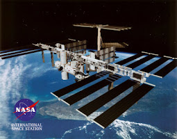
Cargo Transfers, Final Spacewalk Preps for team


Image above: NASA astronaut Rick Mastracchio, STS-131 mission specialist, participates in the mission's second spacewalk as construction and maintenance continue on the International Space Station. Image credit: NASA


Astronauts on space shuttle Discovery will enjoy some well-deserved off-duty time in the morning, then continue to transfer substance from the Leonardo Multi-Purpose Logistics Module and prepare for the final spacewalk of the mission in the afternoon.

Mission Specialists Clayton Anderson and Rick Mastracchio will end their day reviewing the new timeline for Tuesday’s finishing spacewalk and then spend the night in the Quest airlock, sealed off from the rest of the station, at a reduced atmospheric pressure.

Posted by CuttsMatt | at 10:26 PM | 0 comments

NASA’s Discovery Docks, First Time Four Women Share Spacecraft

With the NASA space shuttle Discovery docking at the International Space Station, it’s the first occasion in history four women have been in the same space craft at once.


The crew, which also includes men, is attaching the Leonardo Multi Purpose Logistics Module, or MPLM, to the station’s Harmony module so its 17,000 pounds of science resources and experiments can be transferred to the International Space Station, NASA says.

The work to shift the racks and supplies will occupy much of the combined shuttle and station crews’ time while the two spacecraft are docked.

Posted by CuttsMatt | at 9:58 PM | 0 comments

Discovery Performs Terminal launch Burn

Commander Alan Poindexter and the crew of space shuttle Discovery performed the Terminal Initiation burn at 1:06 a.m. EDT, firing the left Orbital Maneuvering System engine for 10 seconds to steer the shuttle onto the final trail toward the International Space Station.


At 2:42 a.m., Discovery will arrive at a point 600 feet directly below the station. Poindexter will gradually rotate the shuttle through a back flip maneuver to expose the base to Expedition 23 Commander Oleg Kotov and Flight Engineer Soichi Noguchi, who will use digital cameras equipped with 800 millimeter and 400 millimeter lenses to photograph the heat shield.

The images will be sent to Mission Control for evaluation by descriptions experts and mission managers to determine whether Discovery incurred any damage during Monday’s launch. Docking is expected to occur at 3:44 a.m.

Posted by CuttsMatt | at 11:36 PM | 0 comments

NASA gives icy Mars lander one last shot

Orbiter will take note for signs that Phoenix has revived after arctic winter


NASA is giving its long-frozen Phoenix Mars Lander one last opportunity to send a signal, beep or any sign that it has survived the harsh Martian winter with enough of its systems intact to phone home.

From Monday to Friday, NASA's Mars Odyssey orbiter rotating the red planet will listen for the third time in four months to see if the Phoenix Mars Lander has come back to life after experiencing a Martian arctic winter it was not designed to survive.

The first two listening campaigns by the orbiter, conducted in January and February, didn't listen to any signs of life from the lander, which studied the surface of the Martian arctic and confirmed the presence of water ice just below the top surface layer.

Images taken by NASA's Mars Reconnaissance Orbiter in February show the gradual disappearance of surface ice with the inception of Martian spring.

Phoenix landed on Mars on May 25, 2008, and operated successfully in the Martian arctic for about two months longer than its designed three-month mission. But once the sun and temperatures dropped and winter set in, the spacecraft didn't have enough power to remain going. The lander went quiet in November 2008.

Phoenix was not designed to withstand the very low temperatures and the ice load of the Martian arctic winter. But in the unlikely event that the lander's components survived and the spacecraft conventional energy from the rising spring sun, mission managers planned on listening for any signals that Phoenix was waking itself up.
While Odyssey listens for Phoenix throughout 60 overflights next week, the Phoenix site will be in around-the-clock sunshine, maximizing the quantity of sunlight available to the spacecraft's solar panels, should they have survived the winter.

Posted by CuttsMatt | at 11:19 PM | 0 comments

Nasa astronaut gets prepared for blast-off

Technicians at a space centre in Kazakhstan have hoisted a rocket on to its initiate pad ahead of Friday's blast-off.


A NASA astronaut and two Russian cosmonauts will be within and will travel to the International Space Station.

NASA's Tracy Caldwell Dyson and Russians Alexander Skvortsov and Mikhail Kornienko are to flash off at 10.04am (0404 GMT) Friday for their six-month mission in the orbiting science lab.

Workers at the craft's storage shelter slid open the gate just before daybreak on Wednesday and mounted the Soyuz rocket on a flatbed train for slow transportation to the launch site.

Armed police with sniffer dogs walked ahead of the train and a helicopter circled overhead amid heightened defense following the Moscow subway bombings, which killed dozens of people.

Posted by CuttsMatt | at 11:51 PM | 0 comments

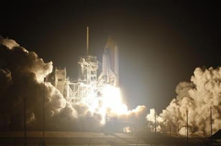
Space Shuttle Mission: STS-131


Image above: On Launch Pad 39A at NASA's Kennedy Space Center in Florida, space shuttle Discovery stands poised for liftoff

-> Meet the STS-131 Crew

Commander Alan Poindexter will lead the STS-131 mission to the International Space Station aboard space shuttle Discovery. Jim Dutton will serve as the pilot. Mission Specialists are Rick Mastracchio, Clay Anderson, Dorothy Metcalf-Lindenburger, Stephanie Wilson and Naoko Yamazaki of the Japan Aerospace Exploration Agency.

Discovery will deliver a multi-purpose logistics module filled with science racks to be transferred to laboratories on the International Space Station. The mission will feature three spacewalks.

Mastracchio and Anderson will conduct three six-and-a-half-hour-long spacewalks on flight days 5, 7 and 9 to replace an ammonia tank assembly, retrieve a Japanese experiment from the station’s exterior and switch out a rate gyro assembly on the S0 element of the station’s truss.

STS-131 is the 33rd shuttle mission to the station.

Posted by CuttsMatt | at 10:42 PM | 1 comments

GOES Satellite Movie Captures evidence-Setting February Blizzards in Washington

During the first two weeks of February 2010, the GOES-12 weather satellite practical a record-setting series of "Nor'easter" snow storms which blanketed the mid-Atlantic coast in two blizzards.


Washington, D.C. normally averages only 16 inches of snow per year, but this year the majority of the season's snowfall arrived over numerous days and the Geostationary Operational Environmental Satellite called GOES-12 captured the storms.

NASA's GOES Project produced a movie of GOES satellite data from February 1-16, 2010 when two blizzards hit the Baltimore, Md. and Washington areas. The GOES-12 operated by the National Oceanic and Atmospheric Administration (NOAA) captures images of U.S. East Coast weather endlessly. Those imagery were compiled into a movie by the NASA GOES Project at NASA's Goddard Space Flight Center, Greenbelt, Md.

"It is a enjoyment to see the fruits of the hard work and commitment from the NASA and NOAA team," said Andre Dress, GOES N-P NASA Deputy Project Manager, at NASA Goddard. "These imagery are very impressive and I am excited to think that these were taken with the older satellites. NOAA plans to put into examination the newer GOES N-P design, this April. I know we will be seeing superior and more exhilarating images this year," Dress said.


For the duration of the first two weeks of February, heavy, wet snows semi-paralyzed Washington. Five inches fell on February 3, 24 inches fell on February 6, and 12 inches on February 10. A second storm followed on February 16 that dumped 10 inches on Philadelphia and New York, but secure Washington and Baltimore.

These storms are called "Nor'easters" because the counter-clockwise circulation around a low strain system on the Atlantic coast pushes moist sea air from the north-east into arctic air over the land. This windy mixture creates a very capable snow-making machine from Boston to Washington. "The GOES movie illustrates how succeeding storms form along the Gulf coast, travel up the Atlantic coast, break over the mid-Atlantic states, and finally slide out to sea," said Dennis Chesters of the NASA GOES Project.

This movie was shaped by overlaying the clouds observed several times per hour by NOAA's GOES Imager onto a true-color map previously derived from NASA's MODIS land-mapping instrument. The infrared channels on GOES detect vapors day and night, which are portrayed as grey for low clouds and white for high clouds. During the day, the visible channel on GOES adds shadow-texture to the exhaust and illuminates the snow on the ground.

The movie compresses 16 days into 2 minutes. It illustrates how continental-scale land/sea/air phenomena come together to make big winter storms. NOAA's ground/space-based observing system and statistical weather models did an excellent job of accurately forecasting the location and depth of each East Coast blizzard in this series.

Posted by CuttsMatt | at 9:47 PM | 0 comments


The Hubble Space Telescope's dramatic glimpse of the Carina Nebula, a gigantic cloud of soil and gas bustling with star-making activity, is a glorious feast for the eyes. Energetic young stars are sculpting a desire landscape of bubbles, valleys, mountains, and pillars. Now this celestial fantasyland has been brought into view for people who cannot explore the figure by sight.

Max Mutchler, a study and instrument scientist at the Space Telescope Science Institute in Baltimore, and Noreen Grice, president of You Can Do Astronomy LLC and author of a number of tactile astronomy books, have created a touchable image of the Carina Nebula that is engaging for everyone, regardless of their visual ability.

The 17-by-11-inch color image is embossed with lines, slashes, and other markings that exchange letters to objects in the giant cloud, allowing visually impaired people to feel what they cannot see and form a picture of the nebula in their minds. The image's design is also useful and intriguing for sighted people who have different learning styles.

"The Hubble image of the Carina Nebula is so beautiful, and it illustrates the whole life cycle of stars," says Mutchler, who, along with Grice, unveiled the tactile Carina image in January 2010, at the American Astronomical Society meeting in Washington, D.C. "I thought that people who are visually impaired should be able to look at it and learn from it, too."

Located 7,500 light-years from Earth, the nebula is a 3-million-year-old gigantic cloud where thousands of stars are cycling all the way through the stages of stellar life and death. The nebula is 300 light-years wide, but Hubble captured a 50-light-year-wide view of its middle region.

A Hubble education and public outreach grant allowed Mutchler to produce the extraordinary image. The grant is part of his Hubble archival research project to create entire mosaics of a huge collection of individual Carina Nebula images taken by Hubble (http://archive.stsci.edu/prepds/carina/). Mutchler made 300 copies of the tactile image and will distribute them to organizations that serve the visually impaired, together with state schools and libraries for the blind and the National Federation of the Blind in Baltimore, Md.

When Mutchler determined to make a tactile Carina Nebula image last year, he immediately called his friend Grice, who is a pioneer in designing tactile astronomy images for the blind.

But Grice says the nebula image is so visually rich, it posed a test to design a textured image that conveys its beauty and complexity.

"When I first looked at the image, I didn't recognize what to focus on," she recalls. "In order to convert the image into a tactile image, I had to make convinced that I understood the individual features that make up the image. There was so much to see."

She tired a couple of hours on the telephone with Mutchler, who gave her a guided tour of the nebula. Then she parsed astronomy books, looking for new views of the nebula. One feature, in particular, gave her a few trouble. It was the Keyhole Nebula. Grice couldn't see how the shape in the figure resembled a keyhole. Finally, she came across a 1950s image of Carina, and unexpectedly, she got it. The name referred to the form of an old-fashioned "skeleton" key. Some visually impaired children who have touched the picture say the feature actually resembles a foot, Grice says.


Choosing which features to show on the textured picture also posed a challenge. Grice says she relied on a lesson she educated from her first NASA tactile astronomy book of Hubble images called "Touch the Universe": less is more.

"Convey just sufficient to get the idea," she says. "Then provide some Braille content that explains the science and describes the scene. A picture that is jammed with various tactile details is very overwhelming for the mind's eye."

Grice used the Keyhole Nebula as the focal point and added extra important features suggested by Mutchler to tell the story of stellar life and death, such as pillars of gas and dust that harbor infant stars, a cluster of young stars called Trumpler 14, and a massive, unstable star, Eta Carinae, that is near the end of its life.

The pair then developed a tactile code identifying the raised features and wrote a short guided tour that provides more in order on the highlighted on the features. The guide and an audio visit of the nebula are on a special Web page called "The Tactile Carina Nebula" (http://amazing-space.stsci.edu/tactile-carina/), on Amazing Space, the Space Telescope Science Institute's education Web site.


A stable of experienced tactile astronomy evaluators, including Vivian Hoette, the education outreach coordinator of the University of Chicago's Yerkes Observatory in Williams Bay, Wis., and Ben Wentworth, a retired teacher from the Colorado School for the Blind in Colorado Springs, Colo., helped test several prototypes of the image. One such evaluation place was the Youth Slam, held in the summer of 2009 in College Park, Md. The National Federation of the Blind coordinated the occurrence to promote careers in math, engineering, and science.

One of the biggest surprises from their trying was the image size. Grice and Mutchler originally thought that a large (almost 6-foot-wide) or medium-sized (3-foot-wide) tactile image would be appropriate for students. The children who sampled the image, however, chosen the much smaller 11-by-17-inch image.

"Many students felt lost with the larger prototype versions because definite objects were separated by empty spaces," Grice says. "However, the lesser version allowed hands to easily track from one object to another."

Adds Hoette, individual of the evaluators: "The smaller size gives them enough details so they can get the big image, and then they can read the science behind it in Braille text, or they can listen to the audio visit on 'The Tactile Carina' Web page while they are touching the image."

The Grice-Mutchler partnership has worked so well that the duo hopes to generate more tactile Hubble images. "It would be huge to build up a catalogue of these images for the visually impaired," Mutchler says.

The Hubble Space Telescope is a assignment of international cooperation between NASA and the European Space Agency. NASA's Goddard Space Flight Center manages the telescope. The institute is operated for NASA by the organization of Universities for Research in Astronomy, Inc. in Washington, D.C.

Posted by CuttsMatt | at 4:23 AM | 0 comments

Herschel Finds Probable Life-Enabling Molecules in Space


The Herschel Space Observatory has exposed the chemical fingerprints of potentially life-enabling organic molecules in the Orion nebula, a nearby stellar nursery in our Milky Way galaxy. Herschel is led by the European Space Agency with important participation from NASA.

The new data, obtained with the telescope's heterodyne gadget for the far infrared -- one of Herschel's three innovative instruments demonstrates the gold mine of information that Herschel will offer on how organic molecules form in space.

The Orion nebula is known to be one of the most prolific chemical factories in space, although the full extent of its chemistry and the pathways for molecule formation are not well understood. By sifting through the pattern of spikes in the new data, called a spectrum, astronomers have recognized a few common molecules that are precursors to life-enabling molecules, including water, carbon monoxide, formaldehyde, methanol, dimethyl ether, hydrogen cyanide, sulfur oxide and sulfur dioxide.

Herschel is a European Space Agency cornerstone mission, with science instruments provided by a consortia of European institutes and with important participation by NASA. NASA's Herschel Project Office is based at NASA's Jet Propulsion Laboratory, Pasadena, Calif. JPL contributed mission-enabling technology for two of Herschel's three science instruments. The NASA Herschel Science Center, part of the Infrared Processing and Analysis Center at the California Institute of Technology in Pasadena, supports the United States astronomical community. Caltech manages JPL for NASA.

Posted by CuttsMatt | at 9:13 PM | 0 comments

NASA Mars Orbiter Speeds Past Data Milestone


NASA's newest Mars orbiter, finishing its fourth year at the Red Planet next week, has just approved a data-volume milestone unimaginable a generation ago and still difficult to fathom: 100 terabits.

That 100 trillion bits of information is more data than in 35 hours of uncompressed high-definition video. It's also more than three times the quantity of data from all other deep-space missions combined -- not just the ones to Mars, but every mission that has flown past the orbit of Earth's moon.

"What is most extraordinary about all these data is not the sheer quantity, but the quality of what they tell us about our neighbor planet," said Mars Reconnaissance Orbiter Project Scientist Rich Zurek, of NASA's Jet Propulsion Laboratory, Pasadena, Calif. "The data from the orbiter's six instruments have given us a much deeper sympathetic of the diversity of environments on Mars today and how they have changed over time."

The spacecraft entered orbit around Mars on March 10, 2006, following an Aug. 12, 2005, launch from Florida. It completed its primary science phase in 2008 and continues investigations of Mars' surface, subsurface and atmosphere.

The orbiter sports a dish antenna 3 meters (10 feet) in diameter and uses it to pour data Earthward at up to 6 megabits per second. Its science instruments are three cameras, a spectrometer for identifying minerals, ground-penetrating radar and an atmosphere sounder.

The ability to return enormous volumes of data enables these instruments to view Mars at unprecedented spatial resolutions. Half the planet has been covered at 6 meters (20 feet) per pixel, and nearly 1 percent of the planet has been observed at about 30 centimeters (1 foot) per pixel, sharp enough to discern objects the size of a desk. The radar, provided by Italy, has looked beneath the surface in 6,500 observing strips, sampling about half the planet.

Among the mission's major findings is that the action of water on and near the surface of Mars occurred for hundreds of millions of years. This action was at least regional and possibly global in extent, though possibly intermittent. The spacecraft has also observed that signatures of a variety of watery environments, some acidic, some alkaline, increase the possibility that there are places on Mars that could reveal evidence of past life, if it ever existed.

JPL, a division of the California Institute of Technology, Pasadena, manages the Mars Reconnaissance Orbiter for NASA's Science Mission Directorate, Washington. Lockheed Martin Space Systems, Denver, is the spacecraft development and integration contractor for the project and built the spacecraft.

The Shallow Radar instrument was provided by the Italian Space Agency, and its operations are led by the InfoCom Department, University of Rome "La Sapienza." Thales Alenia Space Italia, in Rome, is the Italian Space Agency's prime contractor for the radar instrument. Astro Aerospace of Carpinteria, Calif., a business unit of Los Angeles-based Northrop Grumman Corp., developed the instrument's antenna as a subcontractor to Thales Alenia Space Italia.

Posted by CuttsMatt | at 8:46 PM | 0 comments

Salt-Seeking Satellite Shaken By Quake, But Not Stirred


NASA's Aquarius instrument, and the Argentinian spacecraft that will carry it into space, the Satelite de Aplicaciones Cientificas (SAC-D), successfully rode out one of the largest earthquakes in recorded history Feb. 27 with no problems. The instrument and spacecraft are at the satellite systems contractor's satellite integration facility in Bariloche, Argentina. The city of Bariloche, located approximately 588 kilometers, or 365 miles, from the epicenter of the magnitude 8.8 earthquake, experienced light shaking, as indicated by the Modified Mercalli Intensity Scale, which evaluates the effects of earthquakes as experienced by people in the region. No damage was reported to the facility or spacecraft. A separate magnitude 6.3 earthquake in Salta, Argentina, later that day that was triggered by the Chile earthquake was too far away (1,900 kilometers or 1,200 miles) to be felt in Bariloche.

The JPL-built Aquarius instrument is at the Bariloche facility to be integrated with the SAC-D satellite.

Aquarius/SAC-D is an international mission between NASA and Argentina's space agency, Comisión Nacional de Actividades Espaciales. The primary instrument on the mission, Aquarius is designed to provide monthly global maps of how salt concentration varies on the ocean surface -- a key indicator of ocean circulation and its role in climate change. Seven Argentine space agency-sponsored instruments will provide environmental data for a wide range of applications, including natural hazards, land processes, epidemiological studies and air quality issues.

The minimum three-year mission is scheduled to launch late this year from Vandenberg Air Force Base, Calif.

Posted by CuttsMatt | at 8:05 PM | 0 comments

On the JPL Blog: Road-Tripping to Rhea with Cassini


On Tuesday, March 2, 2010, NASA's Cassini spacecraft made its closest encounter yet with Saturn’s second largest moon. This is the mission’s second targeted flyby of the moon in the mission, so it is sometimes referred to as R-2.

Posted by CuttsMatt | at 8:03 PM | 0 comments

NASA, NOAA Ready GOES-P Satellite for March 2 Launch


The Flight Readiness Review for the launch of the Delta IV rocket with GOES-P was held on Feb. 25. The last assessment, the Launch Readiness Review, will be held on March 1.

At Launch Complex 37, closeouts of the Delta IV and GOES-P are commencement. A launch countdown mission dress preparation was successfully completed Friday.

On launch day, the mobile service tower will be retracted away from the Delta IV at 7:30 a.m. The fatal countdown will begin when the countdown clock emerges from a planned built-in hold at 1 p.m.

Posted by CuttsMatt | at 8:48 PM | 0 comments

NASA's Space Shuttle Program Effectively Conducts Final Motor Test in Utah


Space Shuttle Program conducted the last test firing of a reusable solid rocket motor Feb. 25 in Promontory, Utah.


The flight sustains motor, or FSM-17, burned for about 123 seconds -- the same time each reusable solid rocket motor burns during a definite space shuttle launch. Preliminary indications show all test objectives were met. After final test data are analyzed, results for each objective will be published in a NASA report.

ATK Launch Systems, a unit of Alliant Techsystems Inc., in Promontory, north of Salt Lake City, manufactures and tests the solid rocket motors.

The test -- the 52nd conducted for NASA by ATK – marks the closure of a test agenda that has spanned more than three decades. The first test was in July 1977. The ATK-built motors have effectively launched the space shuttle into orbit 129 times.


During space shuttle flights, solid rocket motors provide 80 percent of the thrust during the first two minutes of flight. Each motor, the primary constituent of the shuttle's twin solid rocket boosters, generates an average thrust of 2.6 million pounds and is just over 126 feet long and 12 feet in diameter."Today's test was an enormous deal more than the successful termination to a series of highly successful NASA/ATK-sponsored static tests that began more than three decades ago," said David Beaman, Reusable Solid Rocket Booster project manager at NASA's Marshall Space Flight Center in Huntsville, Ala. The project, part of the Space Shuttle Propulsion Office, is responsible for motor design, development, manufacturing, assembly, and testing and flight performance.


During space shuttle flights, solid rocket motors provide 80 percent of the thrust during the first two minutes of flight. Each motor, the primary constituent of the shuttle's twin solid rocket boosters, generates an average thrust of 2.6 million pounds and is just over 126 feet long and 12 feet in diameter."These tests have built a base of engineering knowledge that continued engineering development of the reusable solid rocket motor system and the continued safe and successful launch of space shuttles," Beaman said. "They have provided an engineering model and lessons learned for additional applications in future launch systems."


The final test was conducted to ensure the safe journey of the four remaining space shuttle missions. A total of 43 design objectives were deliberate through 258 instrument channels during the two-minute static firing. The flight motor tested represents motors that will be used for all residual space shuttle launches.


The space shuttle's reusable solid rocket motor is the major solid rocket motor ever flown, the only one rated for human flight and the first designed for reuse. Each shuttle launch requires the boost of two reusable solid rocket motors to lift the 4.5-million-pound shuttle vehicle.

During space shuttle flights, solid rocket motors provide 80 percent of the thrust during the first two minutes of flight. Each motor, the primary constituent of the shuttle's twin solid rocket boosters, generates an average thrust of 2.6 million pounds and is just over 126 feet long and 12 feet in diameter.

Posted by CuttsMatt | at 9:50 PM | 0 comments

No Signal Heard Throughout First Day of Resumed Listening for Phoenix


NASA's Mars Odyssey began a second campaign Monday to check on whether the Phoenix Mars Lander has revitalized itself after the northern Martian winter. The orbiter established no signal from the lander during the first 10 overflights of this campaign.

Odyssey will pay attention for Phoenix during 50 additional overflights, through Feb. 26, during the current campaign.

Phoenix landed on Mars on May 25, 2008, and operated profitably in the Martian arctic for about two months longer than its planned three-month mission. Operations ended when declining sunlight left the solar-powered craft with insufficient energy to keep working. The season at the Phoenix landing site is now mid-springtime, with the sun above the horizon for roughly 22 hours each Martian day. That is analogous to the illumination that Phoenix experienced a few weeks after finishing its three-month primary mission.

Phoenix was not designed to withstand the tremendously low temperatures and the ice load of the Martian arctic winter. In the tremendously unlikely event that the lander has survived the winter and has achieved a stable energy state, it would operate in a mode where it occasionally awakens and transmits a signal to any orbiter in view.

A third movement to check on whether Phoenix has revived itself is scheduled for April 5-9, when the sun will be continuously above the Martian horizon at the Phoenix site.

Mars Odyssey is managed for NASA's Science Mission Directorate by the Jet Propulsion Laboratory, a division of the California Institute of Technology in Pasadena. Lockheed Martin Space Systems, Denver, is the prime contractor for the project and made the spacecraft. The successful Phoenix mission was led by Peter Smith of the University of Arizona, Tucson, with project management at JPL and development partnership at Lockheed Martin. International contributions came from the Canadian Space Agency; the University of Neuchatel, Switzerland; the universities of Copenhagen and Aarhus in Denmark; the Max Planck Institute in Germany; the Finnish Meteorological Institute; and Imperial College, London.

Posted by CuttsMatt | at 8:46 PM | 0 comments

Temperature Trackers Watch Our Watery World


Climatologists have long recognized that human-produced greenhouse gases have been the dominant drivers of Earth's observed warming since the start of the Industrial Revolution. But other factors also affect our planet's temperature. Of these, the ocean plays a central role. Its effects helped nudge global temperatures slightly higher in 2009, and, according to NASA scientists, could well contribute to making 2010 the warmest year on record.

Covering 71 percent of our planet's surface, the ocean acts as a global thermostat, storing energy from the sun, keeping Earth's temperature changes reasonable and keeping climate change gradual. In fact, the ocean can store as much heat in its top three meters (10 feet) as the entire atmosphere does.

"The vast amount of heat stored in the ocean regulates Earth's temperature, much as a flywheel regulates the speed of an engine," said Bill Patzert, an oceanographer and climatologist at NASA's Jet Propulsion Laboratory in Pasadena, Calif. "The ocean has a long history of capturing and giving up heat generated by both human activities and accepted cycles; it is the thermal memory of the climate system."

Heat and moisture from the ocean are constantly exchanged with Earth's atmosphere in a process that drives our weather and climate. Scientists at NASA and elsewhere use a variety of direct and satellite-based measurements to study the interactions between the ocean and atmosphere.

"These interactions result in large-scale global climate effects, the largest of which is the El Niño-Southern Oscillation," explained Josh Willis, a JPL oceanographer and climate scientist. This climate pattern appears in the tropical Pacific Ocean roughly every four to 12 years and has a powerful impact on the ocean and the atmosphere. It can disrupt global weather and influence hurricanes, droughts and floods. It can also raise or lower global temperatures by up to 0.2 degrees Celsius (0.4 degrees Fahrenheit).

The oscillation pattern is made up of linked atmospheric and oceanic components. The atmospheric component is called the Southern Oscillation, a pattern of reversing surface air pressure that see-saws between the eastern and western tropical Pacific. The ocean's response to this atmospheric shift is known as either "El Niño" or "La Niña" (Spanish for "the little boy" and "the little girl," respectively).

Where the wind blows

During El Niño, the normally strong easterly trade winds in the tropical eastern Pacific weaken, allowing warm water to shift toward the Americas and occupy the entire tropical Pacific. Heavy rains tied to this warm water move into the central and eastern Pacific. El Niño can cause drought in Indonesia and Australia and disrupt the path of the atmospheric jet streams over North and South America, changing winter climate.

Large El Niños, such as the most powerful El Niño of the past century in 1997 to 1998, tend to force Earth's average temperatures temporarily higher for up to a year or more. Large areas of the Pacific can be one to two degrees Celsius (around two to four degrees Fahrenheit) above normal, and the average temperature of the ocean surface tends to increase. The current El Niño began last October and is expected to continue into mid-2010. Scientists at NASA's Goddard Institute of Space Studies in New York estimate that if this pattern persists, 2010 may well go down as the warmest year on record.

El Niño's cold counterpart is La Niña. During La Niña, trade winds are stronger than normal, and cold water that usually sits along the coast of South America gets pushed to the mid-equatorial region of the Pacific. La Niñas are typically associated with less moisture in the air and less rain along the coasts of the Americas, and they tend to cause average global surface temperatures to drop. The last La Niña from 2007 to 2009 helped make 2008 the coolest year of the last decade. The end of that La Niña last year and subsequent transition into an El Niño helped contribute to last year's return to near-record global temperatures.

All the ocean's a stage

Both El Niño and La Niña play out on a larger stage that operates on decade-long timescales. The Pacific Decadal Oscillation, or PDO for short, describes a long-term pattern of change in the Pacific Ocean that alternates between cool and warm periods about every five to 20 years. The PDO can intensify the impacts of La Niña or diminish the impacts of El Niño. In its "cool, negative phase," warm water, which causes higher-than-normal sea-surface heights (because warmer water expands and takes up more space), forms a horseshoe pattern that connects the north, west and south Pacific with cool water in the middle. In its "warm, positive phase," these warm and cool regions are reversed, and warm water forms in the middle of the horseshoe.

Such phase shifts of the PDO result in widespread changes in Pacific Ocean temperatures and have significant global climate implications. During the 1950s and 1960s, the PDO was strongly negative, or cool, and global temperatures seemed to level off. During most of the 1980s, 1990s and 2000s, the Pacific was locked in a strong positive, or warm, PDO phase and there were many El Niños. We are currently in the early stages of a cool PDO phase that began around 2006. Cool, negative phases tend to dampen the effects of El Niños.

Willis said the PDO, El Niño and La Niña can strongly affect global warming due to increased greenhouse gases. "These natural climate phenomena can sometimes hide global warming caused by human activities, or they can have the opposite effect of accentuating it," he explained.

Wild ride

"These natural signals -- El Niños, La Niñas and PDOs -- can modulate the global record for a decade or two, giving us a wild ride with major climate and societal impacts," said Patzert. "They can have a powerful short-term influence on global temperatures in any particular year or decade. This can make it appear as if global warming has leveled off or become global cooling. But when you look at the long-term trend over the past 130 years, our world is definitely getting warmer. And that's the human-produced greenhouse gas signal."

Patzert said the recent climate record is like making a drive from the coast to the mountains. "As you rise slowly to higher and higher elevations, occasionally you hit a major speed bump, such as the 1997 to 1998 El Niño, and temperatures spike; or you hit potholes, such as cooler phases of the PDO, and temperatures dip," he said. "In the end, though, we still tend toward the top of the mountain, and the trend upwards is clear. We are driving ourselves into a warmer world."

Posted by CuttsMatt | at 10:05 PM | 0 comments

NASA Launches "A Warming World"


Will 2010 be the warmest year on record? How do the recent U.S. "Snowmageddon" winter storms and proof low temperatures in Europe fit into the bigger picture of long-term global warming? NASA has launched a fresh Web page to help people better understand the causes and effects of Earth's changing climate.

The new "A Warming World" page hosts a succession of new articles, videos, data visualizations, space-based descriptions and interactive visuals that offer unique NASA perspectives on this topic of global importance.

The page includes characteristic articles that explore the recent Arctic winter weather that has gripped the United States, Europe and Asia, and how El Nino and other longer-term ocean-atmosphere phenomena can affect global temperatures this year and in the future. A new video, "Piecing Together the Temperature Puzzle," illustrates how NASA satellites monitor climate change and help scientists better understand how our complex planet works.

The new Web page is available on NASA's Global Climate Change Web site at: http://climate.nasa.gov/warmingworld .

Posted by CuttsMatt | at 9:56 PM | 0 comments

Cassini Detects Plethora of Plumes, Hotspots at Enceladus


Newly released images from last November's swoop over Saturn's icy moon Enceladus by NASA's Cassini spacecraft reveal a forest of new jets spraying from prominent fractures crossing the south polar region and yield the most detailed temperature map to date of one fracture.

The new images from the imaging science subsystem and the composite infrared spectrometer teams also include the best 3-D image ever obtained of a "tiger stripe," a fissure that sprays icy particles, water vapor and organic compounds. There are also views of regions not well-mapped previously on Enceladus, including a southern area with crudely circular tectonic patterns.

The images and additional information are online at http://www.nasa.gov/cassini and http://saturn.jpl.nasa.gov.

"Enceladus continues to astound," said Bob Pappalardo, Cassini project scientist at NASA's Jet Propulsion Laboratory in Pasadena, Calif. "With each Cassini flyby, we learn more about its extreme activity and what makes this strange moon tick."

For Cassini's visible-light cameras, the Nov. 21, 2009 flyby provided the last look at Enceladus' south polar surface before that region of the moon goes into 15 years of darkness, and includes the most detailed look yet at the jets.

Scientists planned to use this flyby to look for new or smaller jets not visible in previous images. In one mosaic, scientists count more than 30 individual geysers, including more than 20 that had not been seen before. At least one jet spouting prominently in previous images now appears less powerful.

"This last flyby confirms what we suspected," said Carolyn Porco, imaging team lead based at the Space Science Institute in Boulder, Colo. "The vigor of individual jets can vary with time, and many jets, large and small, erupt all along the tiger stripes."

A new map that combines heat data with visible-light images shows a 40-kilometer (25-mile) segment of the longest tiger stripe, known as Baghdad Sulcus. The map illustrates the correlation, at the highest resolution yet seen, between the geologically youthful surface fractures and the anomalously warm temperatures that have been recorded in the south polar region. The broad swaths of heat previously detected by the infrared spectrometer appear to be confined to a narrow, intense region no more than a kilometer (half a mile) wide along the fracture.

In these measurements, peak temperatures along Baghdad Sulcus exceed 180 Kelvin (minus 135 degrees Fahrenheit), and may be higher than 200 Kelvin (minus 100 degrees Fahrenheit). These warm temperatures probably result from heating of the fracture flanks by the warm, upwelling water vapor that propels the ice-particle jets seen by Cassini's cameras. Cassini scientists will be testing this idea by investigating how well the hot spots correspond with the jet sources.

"The fractures are chilly by Earth standards, but they're a cozy oasis compared to the numbing 50 Kelvin (-370 Fahrenheit) of their surroundings," said John Spencer, a composite infrared spectrometer team member based at Southwest Research Institute in Boulder, Colo. "The huge amount of heat pouring out of the tiger stripe fractures may be enough to melt the ice underground. Results like this make Enceladus one of the most exciting places we've found in the solar system."

Some of Cassini's scientists infer that the warmer the temperatures are at the surface, the greater the likelihood that jets erupt from liquid. "And if true, this makes Enceladus' organic-rich, liquid sub-surface environment the most accessible extraterrestrial watery zone known in the solar system," Porco said.

The Nov. 21 flyby was the eighth targeted encounter with Enceladus. It took the spacecraft to within about 1,600 kilometers (1,000 miles) of the moon's surface, at around 82 degrees south latitude.

The Cassini-Huygens mission is a cooperative project of NASA, the European Space Agency and the Italian Space Agency. JPL, a division of the California Institute of Technology in Pasadena, manages the mission for NASA's Science Mission Directorate, Washington, D.C. The Cassini orbiter and its two onboard cameras were designed, developed and assembled at JPL. The imaging operations center is based at the Space Science Institute in Boulder, Colo. The composite infrared spectrometer team is based at NASA's Goddard Space Flight Center, Greenbelt, Md., where the instrument was built.

Posted by CuttsMatt | at 9:40 PM | 0 comments

Endeavour Safely Lands in Florida


Shuttle Launch Integration Manager Mike Moses said that space shuttle Endeavour's hall capped off a flawless mission. "The crew did an exceptional job," Moses said, referring to the complex task of installing Tranquility and its seven-windowed cupola to the International Space Station. "The landing today went as smooth as you can hope for -- by the numbers."

Moses wrapped up his remarks about the STS-130 mission by saying, "It was an exceptional mission -- I can't be happier with the success we had and look forward to repeating that on our next mission."

Shuttle Launch Director Mike Leinbach was extremely pleased with Endeavour's condition."One of the most magical things we get to do here at Kennedy Space Center is walk approximately the orbiter after a mission from space. She looks really, really good," Leinbach said.

Leinbach also congratulated Norm Knight and his team in the Mission Control Center at NASA's Johnson Space Center in Houston for a job well done.

Posted by CuttsMatt | at 11:26 PM | 0 comments

Behold the Aggressive History of Saturn's White Whale Moon


Like the battered white whale Moby Dick pointed Captain Ahab, Saturn's moon Prometheus surges toward the viewer in a 3-D image from NASA's Cassini spacecraft.

The picture exposes the irregular shape and circular surface scars on Prometheus, pointing to a violent history. These craters are almost certainly the remnants from impacts long ago.

Prometheus is one of Saturn's inmost moons. It orbits the gas-giant at a distance of about 140,000 kilometers (86,000 miles) and is 86 kilometers (53 miles) across at its widest point. The porous, icy world was originally discovered in images taken by NASA's Voyager 1 spacecraft back in 1980.

Cassini's narrow-angle camera captured two black-and-white images of the moon on Dec. 26, 2009, and the imaging team combined the images to make this new stereo view. It looks dissimilar from the "egg-cellent" raw image of Prometheus obtained on Jan. 27 because that view shows one of the short ends of the strangely shaped moon. In this 3-D image, the sun illuminate Prometheus at a different angle, making the moon's elongated body visible.

The Cassini Equinox Mission is a joint United States and European endeavor. The Jet Propulsion Laboratory, a division of the California Institute of Technology in Pasadena, manages the mission for NASA's Science Mission Directorate, Washington, D.C. The Cassini orbiter was intended, developed and assembled at JPL. For more information about the Cassini Equinox Mission visit: http://www.nasa.gov/cassini and http://saturn.jpl.nasa.gov.

Posted by CuttsMatt | at 11:22 PM | 0 comments

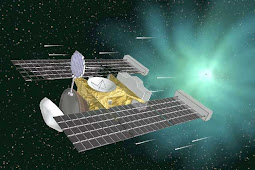
NASA's Stardust Burns for Comet, Less Than a Year Away


Just three days shy of one year before its planned flyby of comet Tempel 1, NASA's Stardust spacecraft has successfully performed a maneuver to adjust the time of its encounter by eight hours and 20 minutes. The delay maximizes the probability of the spacecraft capturing high-resolution images of the desired surface features of the 2.99-kilometer-wide (1.86 mile) potato-shaped mass of ice and dust.

With the spacecraft on the opposite side of the solar system and beyond the orbit of Mars, the trajectory correction maneuver began at 5:21 p.m. EST (2:21 p.m. PST) on Feb. 17. Stardust's rockets fired for 22 minutes and 53 seconds, changing the spacecraft's speed by 24 meters per second (54 miles per hour).

Stardust's maneuver placed the spacecraft on a course to fly by the comet just before 8:42 p.m. PST (11:42 p.m. EST) on Feb. 14, 2011 – Valentine's Day. Time of closest approach to Tempel 1 is important because the comet rotates, allowing different regions of the comet to be illuminated by the sun's rays at different times. Mission scientists want to maximize the probability that areas of interest previously imaged by NASA's Deep Impact mission in 2005 will also be bathed in the sun's rays and visible to Stardust's camera when it passes by.

"We could not have asked for a better result from a burn with even a brand-new spacecraft," said Tim Larson, project manager for the Stardust-NExT at NASA's Jet Propulsion Laboratory, Pasadena, Calif. "This bird has already logged one comet flyby, one Earth return of the first samples ever collected from deep space, over 4,000 days of flight and approximately 5.4 billion kilometers (3.4 billion miles) since launch."

Launched on Feb. 7, 1999, Stardust became the first spacecraft in history to collect samples from a comet and return them to Earth for study. While its sample return capsule parachuted to Earth in January 2006, mission controllers were placing the still viable spacecraft on a trajectory that would allow NASA the opportunity to re-use the already-proven flight system if a target of opportunity presented itself. In January 2007, NASA re-christened the mission "Stardust-NExT" (New Exploration of Tempel), and the Stardust team began a four-and-a-half year journey to comet Tempel 1. This will be humanity's second exploration of the comet – and the first time a comet has been "re-visited."

"Stardust-NExT will provide scientists the first opportunity to see the surface changes on a comet between successive visits into the inner solar system," said Joe Veverka, principal investigator of Stardust-NExT from Cornell University, Ithaca, N.Y. "We have theories galore on how each close pass to the sun causes changes to a comet. Stardust-NExT should give some teeth to some of these theories, and take a bite out of others."

Along with the high-resolution images of the comet's surface, Stardust-NExT will also measure the composition, size distribution, and flux of dust emitted into the coma, and provide important new information on how Jupiter family comets evolve and how they formed 4.6 billion years ago.

Stardust-NExT is a low-cost mission that will expand the investigation of comet Tempel 1 initiated by NASA's Deep Impact spacecraft. JPL, a division of the California Institute of Technology in Pasadena, manages Stardust-NExT for the NASA Science Mission Directorate, Washington, D.C. Joe Veverka of Cornell University is the mission's principal investigator. Lockheed Martin Space Systems, Denver Colo., built the spacecraft and manages day-to-day mission operations.

Posted by CuttsMatt | at 11:12 PM | 0 comments

Missing 'Ice Arches' Contributed to 2007 Arctic Ice Loss


In 2007, the Arctic lost an enormous amount of thick, multiyear sea ice, contributing to that year's record-low extent of Arctic sea ice. A new NASA-led study has create that the record loss that year was due in part to the absence of "ice arches," as expected-forming, curved ice structures that span the openings between two land points. These arches block sea ice from being pushed by winds or currents through narrow passages and out of the Arctic basin.

Beginning each fall, sea ice spreads across the surface of the Arctic Ocean until it becomes restricted by surrounding continents. Only a few passages -- including the Fram Strait and Nares Strait -- allow sea ice to escape.

"There are a couple of ways to lose Arctic ice: when it flows out and when it melts," said lead study investigator Ron Kwok of NASA's Jet Propulsion Laboratory in Pasadena, Calif. "We are trying to enumerate how much we're losing by outflow versus melt."

Kwok and colleagues found that ice arches were absent in 2007 from the Nares Strait, a relatively narrow 30- to 40-kilometer-wide (19- to 25-mile-wide) passage west of Greenland. Without the arches, ice exited freely from the Arctic. The Fram Strait, east of Greenland, is about 400 kilometers (249 miles) wide and is the channel through which most sea ice usually exits the Arctic.

Despite Nares' narrow width, the team reports that in 2007, ice loss through Nares equaled more than 10 percent of the quantity emptied on average each year through the wider Fram Strait.

"Until recently, we didn't think the small straits were important for ice loss," Kwok said. The findings were available this month in Geophysical Research Letters.

"One of our most significant goals is developing predictive models of Arctic sea ice cover," said Tom Wagner, cryosphere program manager at NASA Headquarters in Washington. "Such models are significant not only to understanding changes in the Arctic, but also changes in global and North American climate. Figuring out how ice is lost through the Fram and Nares straits is critical to increasing those models."

To find out more about the ice motion in Nares Strait, the scientists examined a 13-year record of high-resolution radar descriptions from the Canadian RADARSAT and European Envisat satellites. They found that 2007 was a unique year – the only one on record when arches failed to form, allowing ice to flow unobstructed through winter and spring.

The arches usually form at southern and northern points within Nares Strait when big blocks of sea ice try to flow during the strait's restricted confines, become stuck and are compressed by other ice. This grinds the flow of sea ice to a halt.

"We don't completely understand the circumstances conducive to the formation of these arches," Kwok said. "We do know that they are temperature-dependent because they only form in winter. So there's anxiety that if climate warms, the arches could stop forming."

To quantify the impact of ice arches on Arctic Ocean ice cover, the team tracked ice motion evident in the 13-year span of satellite radar images. They calculated the area of ice passing during an imaginary line, or "gate," at the entrance to Nares Strait. Then they incorporated ice thickness data from NASA's ICESat to estimate the volume lost through Nares.

They found that in 2007, Nares Strait drained the Arctic Ocean of 88,060 square kilometers (34,000 square miles) of sea ice, or a volume of 60 cubic miles. The quantity was more than twice the average amount lost through Nares each year between 1997 and 2009.

The ice lost through Nares Strait was some of the thickest and oldest in the Arctic Ocean.

"If indeed these arches are less likely to form in the future, we have to explanation for the annual ice loss through this narrow passage. Potentially, this could lead to an even more rapid decline in the summer ice extent of the Arctic Ocean," Kwok said.

Posted by CuttsMatt | at 11:05 PM | 0 comments

Jurassic Space: Telescopes Probe Ancient Galaxies Close To Us


Imagine discovering a living dinosaur in your backyard. Astronomers have found the astronomical corresponding of prehistoric life in our intergalactic backyard: a group of small, early galaxies that has waited 10 billion years to come together. These "late bloomers" are on their way to building a large elliptical galaxy.

Such encounters between dwarf galaxies are usually seen billions of light-years away and therefore occurred billions of years ago. But these galaxies, members of Hickson Compact Group 31, are comparatively nearby, only 166 million light-years away.

New images of this foursome by NASA's Hubble Space Telescope offer a window into the determining years of the universe, when the buildup of large galaxies from smaller construction blocks was common. The analysis was bolstered by infrared data from NASA's Spitzer Space Telescope and ultraviolet observations from NASA's Galaxy Evolution Explorer and Swift satellite. Those data helped the astronomers measure the total amount of star formation in the system.

Posted by CuttsMatt | at 9:09 PM | 0 comments

Enhanced 3D Model of Mars Crater Edge Display’s Ups and Downs


A dramatic 3D Mars view based on land modeling from NASA's Mars Reconnaissance Orbiter data shows "highs and lows" of Mojave Crater.

The vertical dimension is overstated three-fold compared with horizontal dimensions in the synthesized imagery of a portion of the crater's wall. The resulting images look like the view from a low-altitude aircraft. They reflect one use of digital modeling resulting from two observations by the orbiter's High Resolution Imaging Science Experiment camera.

This enhanced view shows material that has ponded and is backed up behind enormous blocks of bedrock in the crater's terrace walls. Hundreds of Martian collision craters have similar ponding with pitted surfaces. Scientists believe these "pitted ponds" are formed when material melted by the crater-causing impacts is captured behind the wall terraces.

Mojave Crater, one of the freshest large craters on Mars, is about 60 kilometers (37 miles) in diameter. In a sense, it is like the Rosetta Stone of Martian craters, because it is so fresh. Other craters of this size usually have already been affected by erosion, sediment and other geologic process. Fresh craters like Mohave reveal information about the collision process, including ejecta, melting and deposits.

Posted by CuttsMatt | at 9:00 PM | 0 comments

NASA's WISE Mission Releases Medley of First Images


A varied cast of cosmic characters is showcased in the first survey images NASA released Wednesday from its Wide-field Infrared Survey Explorer, or WISE.

Since WISE began its scan of the complete sky in infrared light on Jan. 14, the space telescope has beamed back more than a quarter of a million raw, infrared images. Four new, processed pictures demonstrate a sampling of the mission's targets a wispy comet, a bursting star-forming cloud, the grand Andromeda galaxy and a faraway cluster of hundreds of galaxies. http://www.nasa.gov/mission_pages/WISE/multimedia/images20100216.html (see images) .

"WISE has worked excellently," said Ed Weiler, associate administrator of the Science Mission Directorate at NASA Headquarters in Washington. "These first images are proving the spacecraft's minor mission of helping to track asteroids, comets and other stellar objects will be just as significantly important as its primary mission of surveying the entire sky in infrared."

One image shows the attractiveness of a comet called Siding Spring. As the comet parades toward the sun, it sheds dust that glows in infrared light visible to WISE. The comet's tail, which stretches about 10 million miles, looks like a streak of red paint. A bright star appears below it in blue.

"We've got a candy store of descriptions coming down from space," said Edward (Ned) Wright of UCLA, the principal researcher for WISE. "Everyone has their favorite flavors, and we've got them all."

During its survey, the mission is predictable to find perhaps dozens of comets, including some that ride along in orbits that take them somewhat close to Earth's path around the sun. WISE will help unravel clues locked inside comets about how our solar system came to be.


Another image shows a bright and choppy star-forming region called NGC 3603, lying 20,000 light-years away in the Carina spiral arm of our Milky Way galaxy. This star-forming factory is churning out batches of new stars, some of which are monstrously massive and hotter than the sun. The hot stars warm the surrounding dust clouds, causing them to glow at infrared wavelengths.

WISE will see hundreds of similar star-making regions in our galaxy, helping astronomers piece mutually a picture of how stars are born. The observations also offer an important link to understanding violent episodes of star formation in distant galaxies. Because NGC 3603 is much closer, astronomers use it as a lab to probe the same type of action that is taking place billions of light-years away.

Traveling farther out from our Milky Way, the third new image shows our adjacent large neighbor, the Andromeda spiral galaxy. Andromeda is a bit bigger than our Milky Way and about 2.5 million light-years away. The new picture highlights WISE's wide field of view -- it covers an area larger than 100 full moons and even shows other smaller galaxies near Andromeda, all belonging to our "local group" of more than about 50 galaxies. WISE will capture the entire local group.

The fourth WISE image is even farther out, in a region of hundreds of galaxies all bound together into one family. Called the Fornax cluster, these galaxies are 60 million light-years from Earth. The mission's infrared views reveal both sluggish and active galaxies, providing a census of data on an entire galactic community.

"All these pictures tell a story about our dusty origins and destiny," said Peter Eisenhardt, the WISE project scientist at NASA's Jet Propulsion Laboratory in Pasadena, Calif. "WISE sees dusty comets and rocky asteroids tracing the configuration and evolution of our solar system. We can map thousands of forming and dying solar systems across our entire galaxy. We can see patterns of star configuration across other galaxies, and waves of star-bursting galaxies in clusters millions of light years away."

Other mission targets include comets, asteroids and cool stars called brown dwarfs. WISE discovered its first near-Earth asteroid on Jan. 12, and first comet on Jan. 22. The mission will scan the sky one-and-a-half times by October. At that point, the frozen coolant needed to chill its instruments will be depleted.

JPL manages WISE for NASA's Science Mission Directorate. The mission was competitively selected under NASA's Explorers Program, which NASA's Goddard Space Flight Center in Greenbelt, Md., manages. The Space Dynamics Laboratory in Logan, Utah, built the science instrument, and Ball Aerospace & Technologies Corp. of Boulder, Colo., built the spacecraft. Science operations and data processing take place at the Infrared Processing and Analysis Center at the California Institute of Technology in Pasadena. Caltech manages JPL for NASA. For more information about WISE, visit http://www.nasa.gov/wise and http://wise.astro.ucla.edu/ and http://www.jpl.nasa.gov/wise.

Posted by CuttsMatt | at 8:42 PM | 0 comments

Get Ready For A Possible Glimpse Of An Asteroid


The most important asteroid in the sky is currently yours for the perusing with binoculars -- and perhaps even the naked eye.

Tonight, Wednesday, Feb. 17, Vesta, the second most massive object in the asteroid belt, reaches what astronomers like to call "opposition." An asteroid (or planet or comet) is said to be "in opposition" when it is conflicting to the sun as seen from Earth. In other words, if you were to stand outside with the sun directly above you at high noon, Vesta would be straight below your feet some 211,980,000 kilometers (131,700,000 miles) away. With Vesta at opposition, the asteroid is at its adjoining point to Earth in its orbit.

Wednesday night, the asteroid is predictable to shine at magnitude 6.1. That brightness should make it visible to concerned parties brandishing telescopes or binoculars, and even those blessed with excellent vision and little or no light pollution or clouds in their vicinity. Vesta will be visible in the eastern sky in the constellation Leo.

What makes this space rock so famous these days? Along with its relative proximity at this point, a full half of the asteroid is being bathed by sunlight when seen from Earth, making it emerge brighter. Another attribute working in the observer's favor is that Vesta has a exclusive surface material that is not as dark as most main belt asteroids - allowing more of the sun's rays to reflect off its surface.

If spotting Vesta in the night sky has whetted your appetite for mega-rocks, all we can say is, stay tuned. NASA's Dawn spacecraft, currently motoring its way through the asteroid belt, will begin its exploration of Vesta in the summer of 2011.

Posted by CuttsMatt | at 8:53 PM | 0 comments

Cassini Shoots New Close-Ups of Death Star-like Moon


Blazing through its closest pass of the Saturnian moon Mimas on Feb. 13, Cassini sent back prominent close-ups of the moon likened to the Death Star from "Star Wars" and the massive crater scarring its surface. The flyby also yielded solid data on the moon's thermal signature and surface composition.

Some of the raw, unprocessed pictures sent back from the flyby show the bright, steep slopes of the giant Herschel Crater, which measures about 140 kilometers (88 miles) wide. The icy slopes appear to be pitched around 24 degrees, which would possibly earn them a black- or double-black-diamond rating on Earth. Olympic downhill skiers could probably tear down these runs with ease, but it's clear Mimas is no place for bunny-slope beginners.

The images, which have the highest resolution so far, also explain jumbled terrain inside the crater and many craters within the crater. These features hint at a long history, which scientists will be working meticulously to analyze.

"This flyby has been like looking at a cell or an onion skin under the microscope for the first time," said Bonnie Buratti, one of the leads for the Satellite Orbiter Science Team. "We'd seen the large crater from afar because the early 1980s, but now its small bumps and blemishes are all obviously visible."

This encounter took the spacecraft as close as about 9,500 kilometers (5,900 miles) above Mimas. Cassini had to contrive through a dusty region to get in position, but survived the trip untouched, as expected.

The moon averages 396 kilometers (246 miles) in diameter. The walls of Herschel Crater are about 5 kilometers (3 miles) high, and parts of the floor are approximately 10 kilometers (6 miles) deep.

Unprocessed images of the flyby are available at http://saturn.jpl.nasa.gov/photos/raw/. More information about the Cassini mission is at http://www.nasa.gov/cassini and http://saturn.jpl.nasa.gov.

Posted by CuttsMatt | at 8:39 PM | 0 comments

Voyager Celebrates 20-Year-Old Valentine to Solar System


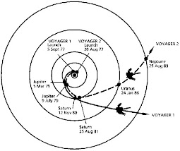
Twenty years ago on February 14, NASA's Voyager 1 spacecraft had sailed beyond the farthest planet in our solar system and turned its camera inward to snap a series of final descriptions that would be its parting valentine to the string of planets it called home.

Mercury was too close to the sun to see, Mars showed only a thin crescent of sunlight, and Pluto was too dim, but Voyager was able to capture cameos of Neptune, Uranus, Saturn, Jupiter, Earth and Venus from its unique vantage point. These images, later agreed in a large-scale mosaic, make up the only family portrait of our planets arrayed about the sun.

The Apollo missions in the 1960s and 70s had already altered our perspective of Earth by returning descriptions of our home planet from the moon, but Voyager was providing a completely new perspective, said Ed Stone, Voyager project scientist at the California Institute of Technology in Pasadena.

"It captured the Earth as a speck of light in the immensity of the solar system, which is our local neighborhood in the Milky Way galaxy, in a universe replete with galaxies," Stone said.

In the years since the twin Voyager spacecraft were launched in 1977, they had previously sent back breathtaking, groundbreaking pictures of the gas giants Jupiter, Saturn, Uranus and Neptune. It took Voyager 1 more than 12 years to reach the place where it took the group portrait, 6 billion kilometers (almost 4 billion miles) away from the sun. The imaging team started snapping images of the outer planets first since they were worried that pointing the camera near the sun would blind it and prevent more picture-taking.

Candy Hansen, a planetary scientist based at NASA's Jet Propulsion Laboratory in Pasadena, Calif., who worked with the Voyager imaging team at the time, remembers combing through the pictures and finally finding the image of Earth. She had seen so many pictures over the years that she could distinguish dust on the lens from the black dots imprinted on the lens for geometric correction.

There was our planet, a bright speck sitting in a kind of spotlight of sunlight spotted by the camera. Hansen still gets chills thinking about it.

"I was struck by how special Earth was, as I saw it shining in a ray of sunlight," she said. "It also made me think about how susceptible our tiny planet is."

This was the image that inspired Carl Sagan, the the Voyager imaging team member who had optional taking this portrait, to call our home planet "a pale blue dot."

As he wrote in a book by that name, "That's here. That's home. That's us. On it everyone you love, everyone you know, everyone you ever heard of, every person being who ever was, lived out their lives. … There is perhaps no better demonstration of the folly of human conceits than this distant image of our tiny world."

After these images were taken, mission managers started powering down the cameras. The spacecraft weren't going to fly near anything else, and other instrument that were still collecting data needed power for the long journey to interstellar space that was ahead.

The Voyagers are still transmitting data daily back to Earth. Voyager 1 is now nearly 17 billion kilometers (more than 10 billion miles) away from the sun. The spacecraft have continued on to the next leg of their interstellar mission, closing in on the boundary of the bubble fashioned by the sun that envelops all the planets. Scientists eagerly await the time when the Voyagers will leave that bubble and enter interstellar space.

"We were marveling at the vastness of space when this portrait was taken, but 20 years later, we're still inside the bubble," Stone said. "Voyager 1 may leave the solar bubble in five more years, but the family portrait gives you a sense of the scale of our neighborhood and that there is a great deal beyond it yet to be discovered."

The Voyagers were built by JPL, which continues to operate both spacecraft. Caltech manages JPL for NASA.

Posted by CuttsMatt | at 9:13 PM | 0 comments

WISE Spies a Comet with its Powerful Infrared Eye


NASA's Wide-field Infrared Survey Explorer, or WISE, has exposed its first comet, one of many the mission is expected to find among millions of other objects during its ongoing survey of the whole sky in infrared light.

Officially named "P/2010 B2 (WISE)," but known merely as WISE, the comet is a dusty mass of ice more than 2 kilometers (1.2 miles) in diameter. It probably formed around the same time as our solar system, about 4.5 billion years ago. Comet WISE started out in the cold, dark reaches of our solar system, but after a long history of getting knocked around by the gravitational forces of Jupiter, it settled into an orbit much quicker to the sun. Right now, the comet is heading away from the sun and is about 175 million kilometers (109 million miles) from Earth.

"Comets are ancient reservoirs of water. They are one of the few places in addition Earth in the inner solar system where water is known to exist," said Amy Mainzer of NASA's Jet Propulsion Laboratory in Pasadena, Calif. Mainzer is the principal investigator of NEOWISE, a project to find and catalog new asteroids and comets spotted by WISE (the acronym combines WISE with NEO, the shorthand for near-Earth object).

"With WISE, we have a powerful tool to find new comets and learn more about the population as a whole. Water is necessary for life as we know it, and comets can tell us more about how much there is in our solar system."

The WISE telescope, which launched into a polar orbit around Earth on Dec. 14, 2009, is expected to discover anywhere from a few to dozens of new comets, in addition to hundreds of thousands of asteroids. Comets are harder to find than asteroids because they are much more rare in the inner solar system. Whereas asteroids tour around in the "main belt" between the orbits of Mars and Jupiter, large numbers of comets orbit farther away, in the icy outer reaches of our solar system.

Both asteroids and comets can fall into orbits that bring them close to Earth's path around the sun. Most of these "near-Earth objects" are asteroids but some are comets. WISE is expected to find new near-Earth comets, and this will give us a better idea of how threatening they might be to Earth.

"It is very unlikely that a comet will hit Earth," said James Bauer, a scientist at JPL working on the WISE project, "But, in the rare chance that one did, it could be dangerous. The new discoveries from WISE will give us more precise statistics about the probability of such an event, and how powerful an impact it might yield."

The space telescope spotted the comet during its routine scan of the sky on January 22. Sophisticated software plucked the comet out from the stream of images pouring down from space by looking for objects that move quickly relative to background stars. The comet discovery was followed up by a combination of professional and amateur astronomers using telescopes across the United States.

A teacher also teamed up with an observer to measure comet WISE using a home-built telescope next to a cornfield in Illinois. Their research is part of the International Astronomical Search Collaboration, an education program that helps teachers and students observe comets and asteroids (more information is online at http://iasc.hsutx.edu/).

All the data are catalogued at the Minor Planet Center, in Cambridge, Mass., the worldwide clearinghouse for all observations and orbits of minor planets and comets.

Comet WISE takes 4.7 years to circle the sun, with its farthest point being about 4 astronomical units away, and its closest point being 1.6 astronomical units (near the orbit of Mars). An astronomical unit is the distance between Earth and the sun. Heat from the sun causes gas and dust to blow off the comet, resulting in a dusty coma, or shell, and a tail.


Though this particular body is actively shedding dust, WISE is also expected to find dark, dead comets. Once a comet has taken many trips around the sun, its icy components erode away, leaving only a dark, rocky core. Not much is known about these objects because they are hard to see in visible light. WISE's infrared sight should be able to pick up the feeble glow of some of these dark comets, answering questions about precisely how and where they form.

"Dead comets can be darker than coal," said Mainzer. "But in infrared light, they will pop into view. One question we want to answer with WISE is how many dead comets make up the near-Earth object population."

The mission will spend the next eight months mapping the sky one-and-a-half times. A first batch of data will be available to the public in the spring of 2011, and the final catalog a year later. Selected images and findings will be released throughout the mission.

JPL manages the Wide-field Infrared Survey Explorer for NASA's Science Mission Directorate, Washington. The principal investigator, Edward Wright, is at UCLA. The mission was competitively selected under NASA's Explorers Program managed by the Goddard Space Flight Center, Greenbelt, Md. The science instrument was built by the Space Dynamics Laboratory, Logan, Utah, and the spacecraft was built by Ball Aerospace & Technologies Corp., Boulder, Colo. Science operations and data processing take place at the Infrared Processing and Analysis Center at the California Institute of Technology in Pasadena. Caltech manages JPL for NASA. The ground-based observations are partly supported by the National Science Foundation. The Minor Planet Center is funded by NASA. More information is online at http://www.nasa.gov/wise and http://wise.astro.ucla.edu.

Posted by CuttsMatt | at 8:48 PM | 0 comments

Layers Piled in a Mars Crater Record a History of Changes


Near the center of a Martian crater about the size of Connecticut, hundreds of exposed rock layers form a mound as tall as the Rockies and expose a record of major environmental changes on Mars billions of years ago.


The history told by this tall parfait of layers inside Gale Crater matches what has been proposed in current years as the dominant planet-wide pattern for early Mars, according to a new report by geologists using instruments on NASA's Mars Reconnaissance Orbiter.

"Looking at the layers from the bottom to the top, from the oldest to the youngest, you see a sequence of varying rocks that resulted from changes in environmental conditions through time," said Ralph Milliken of NASA's Jet Propulsion Laboratory, Pasadena, Calif. "This thick sequence of rocks appears to be showing different steps in the drying-out of Mars."

Using geological layers to comprehend stages in the evolution of a planet's climate has a precedent on Earth. A change about 1.8 billion years ago in the types of rock layers formed on Earth became a key to understanding a dramatic change in Earth's ancient atmosphere.


Milliken and two co-authors report in Geophysical Research Letters those clay minerals, which form under very wet conditions, are concentrated in layers near the bottom of the Gale stack. Above that, sulfate minerals are intermixed with the clays. Sulfates form in wet circumstances and can be deposited when the water in which they are dissolved evaporates. Higher still are sulfate-containing layers without detectable clays. And at the top is a thick formation of regularly spaced layers bearing no detectable water-related minerals.


Rock exposures with compositions like various layers of the Gale stack have been mapped elsewhere on Mars, and researchers, including Jean-Pierre Bibring of the University of Paris, have planned a Martian planetary chronology of clay-producing conditions followed by sulfate-producing conditions followed by dry conditions. However, Gale is the first location where a particular series of layers has been found to contain these clues in a clearly defined sequence from older rocks to younger rocks.

"If you could stand there, you would see this beautiful formation of Martian sediments laid down in the past, a stratigraphic section that's more than twice the height of the Grand Canyon, though not as steep," said Bradley Thomson of the Johns Hopkins University Applied Physics Laboratory, Laurel, Md. He and John Grotzinger of the California Institute of Technology in Pasadena are Milliken's co-authors.


NASA selected Gale Crater in 2008 as one of four finalist sites for the Mars Science Laboratory rover, Curiosity, which has a planned launch in 2011. The finalist sites all have exposures of water-related minerals, and each has attributes that distinguish it from the others. This new report is an example of how observations made for evaluating the landing-site candidates are providing valuable science results even before the rover mission launches.


Three instruments on NASA's Mars Reconnaissance Orbiter have provided key data about the layered mound in Gale Crater. Images from the High Resolution Imaging Science Experiment camera reveal details used to map hundreds of layers. Using stereo pairs of the images, the U.S. Geological Survey has generated three-dimensional models used to discern elevation differences as small as a meter (about a yard). Observations by the Compact Reconnaissance Imaging Spectrometer for Mars yielded information about minerals on the surface. The Context Camera provided broader-scale images showing how the layers fit geologically into their surroundings.

Thomson said, "This work demonstrates the synergy of the instruments on the Mars Reconnaissance Orbiter. We wouldn't have as complete a picture if we were missing any of the components."

The mission has been studying Mars since 2006. It has returned more data from the planet than all other Mars missions combined. More information about this mission is at http://www.nasa.gov/mro.

Malin Space Science Systems, San Diego, provided and operates the Context Camera. Johns Hopkins University Applied Physics Laboratory provided and operates the Compact Reconnaissance Imaging Spectrometer. The University of Arizona Lunar and Planetary Laboratory, Tucson, operates the High Resolution Imaging Science Experiment, which was built by Ball Aerospace & Technologies Corp., Boulder, Colo.

JPL, a division of Caltech, manages the Mars Reconnaissance Orbiter for NASA's Science Mission Directorate, Washington. Lockheed Martin Space Systems, Denver, is the prime contractor for the project and built the spacecraft.

Posted by CuttsMatt | at 8:27 PM | 0 comments