Showing posts with label Nasa News. Show all posts

Scientists Say Ice Lurks in Asteroid's Cold Heart

Scientists using a NASA funded telescope have detected water-ice and carbon-based organic compounds on the surface of an asteroid. The cold hard facts of the discovery of the frosty mixture on one of the asteroid belt's largest occupants, suggests that some asteroids, along with their celestial brethren, comets, were the water carriers for a primordial Earth. The research is published in today's issue of the journal Nature.


"For a long time the thinking was that you couldn't find a cup's worth of water in the entire asteroid belt," said Don Yeomans, manager of NASA's Near-Earth Object Program Office at the Jet Propulsion Laboratory in Pasadena, Calif. "Today we know you not only could quench your thirst, but you just might be able to fill up every pool on Earth – and then some."

The discovery is a result of six years of observing asteroid 24 Themis by astronomer Andrew Rivkin of the Johns Hopkins University Applied Physics Laboratory in Laurel, Maryland. Rivkin, along with Joshua Emery, of the University of Tennessee in Knoxville, employed the NASA Infrared Telescope Facility to take measurements of the asteroid on seven separate occasions beginning in 2002. Buried in their compiled data was the consistent infrared signature of water ice and carbon-based organic materials.

The study's findings are particularly surprising because it was believed that Themis, orbiting the sun at "only" 479 million kilometers (297 million miles), was too close to the solar system's fiery heat source to carry water ice left over from the solar system's origin 4.6 billion years ago.

Now, the astronomical community knows better. The research could help re-write the book on the solar system's formation and the nature of asteroids.

"This is exciting because it provides us a better understanding about our past – and our possible future," said Yeomans. "This research indicates that not only could asteroids be possible sources of raw materials, but they could be the fueling stations and watering holes for future interplanetary exploration."

Rivkin and Emory's findings were independently confirmed by a team led by Humberto Campins at the University of Central Florida in Orlando.

NASA detects, tracks and characterizes asteroids and comets passing close to Earth using both ground- and space-based telescopes. The Near-Earth Object Observations Program, commonly called "Spaceguard," discovers these objects, characterizes a subset of them, and plots their orbits to determine if any could be potentially hazardous to our planet.

JPL manages the Near-Earth Object Program Office for NASA's Science Mission Directorate in Washington. JPL is a division of the California Institute of Technology in Pasadena.

Posted by CuttsMatt | at 3:05 AM | 1 comments

NASA’s Discovery Docks, First Time Four Women Share Spacecraft

With the NASA space shuttle Discovery docking at the International Space Station, it’s the first occasion in history four women have been in the same space craft at once.


The crew, which also includes men, is attaching the Leonardo Multi Purpose Logistics Module, or MPLM, to the station’s Harmony module so its 17,000 pounds of science resources and experiments can be transferred to the International Space Station, NASA says.

The work to shift the racks and supplies will occupy much of the combined shuttle and station crews’ time while the two spacecraft are docked.

Posted by CuttsMatt | at 9:58 PM | 0 comments

Discovery Performs Terminal launch Burn

Commander Alan Poindexter and the crew of space shuttle Discovery performed the Terminal Initiation burn at 1:06 a.m. EDT, firing the left Orbital Maneuvering System engine for 10 seconds to steer the shuttle onto the final trail toward the International Space Station.


At 2:42 a.m., Discovery will arrive at a point 600 feet directly below the station. Poindexter will gradually rotate the shuttle through a back flip maneuver to expose the base to Expedition 23 Commander Oleg Kotov and Flight Engineer Soichi Noguchi, who will use digital cameras equipped with 800 millimeter and 400 millimeter lenses to photograph the heat shield.

The images will be sent to Mission Control for evaluation by descriptions experts and mission managers to determine whether Discovery incurred any damage during Monday’s launch. Docking is expected to occur at 3:44 a.m.

Posted by CuttsMatt | at 11:36 PM | 0 comments

NASA gives icy Mars lander one last shot

Orbiter will take note for signs that Phoenix has revived after arctic winter


NASA is giving its long-frozen Phoenix Mars Lander one last opportunity to send a signal, beep or any sign that it has survived the harsh Martian winter with enough of its systems intact to phone home.

From Monday to Friday, NASA's Mars Odyssey orbiter rotating the red planet will listen for the third time in four months to see if the Phoenix Mars Lander has come back to life after experiencing a Martian arctic winter it was not designed to survive.

The first two listening campaigns by the orbiter, conducted in January and February, didn't listen to any signs of life from the lander, which studied the surface of the Martian arctic and confirmed the presence of water ice just below the top surface layer.

Images taken by NASA's Mars Reconnaissance Orbiter in February show the gradual disappearance of surface ice with the inception of Martian spring.

Phoenix landed on Mars on May 25, 2008, and operated successfully in the Martian arctic for about two months longer than its designed three-month mission. But once the sun and temperatures dropped and winter set in, the spacecraft didn't have enough power to remain going. The lander went quiet in November 2008.

Phoenix was not designed to withstand the very low temperatures and the ice load of the Martian arctic winter. But in the unlikely event that the lander's components survived and the spacecraft conventional energy from the rising spring sun, mission managers planned on listening for any signals that Phoenix was waking itself up.
While Odyssey listens for Phoenix throughout 60 overflights next week, the Phoenix site will be in around-the-clock sunshine, maximizing the quantity of sunlight available to the spacecraft's solar panels, should they have survived the winter.

Posted by CuttsMatt | at 11:19 PM | 0 comments

Herschel Finds Probable Life-Enabling Molecules in Space


The Herschel Space Observatory has exposed the chemical fingerprints of potentially life-enabling organic molecules in the Orion nebula, a nearby stellar nursery in our Milky Way galaxy. Herschel is led by the European Space Agency with important participation from NASA.

The new data, obtained with the telescope's heterodyne gadget for the far infrared -- one of Herschel's three innovative instruments demonstrates the gold mine of information that Herschel will offer on how organic molecules form in space.

The Orion nebula is known to be one of the most prolific chemical factories in space, although the full extent of its chemistry and the pathways for molecule formation are not well understood. By sifting through the pattern of spikes in the new data, called a spectrum, astronomers have recognized a few common molecules that are precursors to life-enabling molecules, including water, carbon monoxide, formaldehyde, methanol, dimethyl ether, hydrogen cyanide, sulfur oxide and sulfur dioxide.

Herschel is a European Space Agency cornerstone mission, with science instruments provided by a consortia of European institutes and with important participation by NASA. NASA's Herschel Project Office is based at NASA's Jet Propulsion Laboratory, Pasadena, Calif. JPL contributed mission-enabling technology for two of Herschel's three science instruments. The NASA Herschel Science Center, part of the Infrared Processing and Analysis Center at the California Institute of Technology in Pasadena, supports the United States astronomical community. Caltech manages JPL for NASA.

Posted by CuttsMatt | at 9:13 PM | 0 comments

NASA Mars Orbiter Speeds Past Data Milestone


NASA's newest Mars orbiter, finishing its fourth year at the Red Planet next week, has just approved a data-volume milestone unimaginable a generation ago and still difficult to fathom: 100 terabits.

That 100 trillion bits of information is more data than in 35 hours of uncompressed high-definition video. It's also more than three times the quantity of data from all other deep-space missions combined -- not just the ones to Mars, but every mission that has flown past the orbit of Earth's moon.

"What is most extraordinary about all these data is not the sheer quantity, but the quality of what they tell us about our neighbor planet," said Mars Reconnaissance Orbiter Project Scientist Rich Zurek, of NASA's Jet Propulsion Laboratory, Pasadena, Calif. "The data from the orbiter's six instruments have given us a much deeper sympathetic of the diversity of environments on Mars today and how they have changed over time."

The spacecraft entered orbit around Mars on March 10, 2006, following an Aug. 12, 2005, launch from Florida. It completed its primary science phase in 2008 and continues investigations of Mars' surface, subsurface and atmosphere.

The orbiter sports a dish antenna 3 meters (10 feet) in diameter and uses it to pour data Earthward at up to 6 megabits per second. Its science instruments are three cameras, a spectrometer for identifying minerals, ground-penetrating radar and an atmosphere sounder.

The ability to return enormous volumes of data enables these instruments to view Mars at unprecedented spatial resolutions. Half the planet has been covered at 6 meters (20 feet) per pixel, and nearly 1 percent of the planet has been observed at about 30 centimeters (1 foot) per pixel, sharp enough to discern objects the size of a desk. The radar, provided by Italy, has looked beneath the surface in 6,500 observing strips, sampling about half the planet.

Among the mission's major findings is that the action of water on and near the surface of Mars occurred for hundreds of millions of years. This action was at least regional and possibly global in extent, though possibly intermittent. The spacecraft has also observed that signatures of a variety of watery environments, some acidic, some alkaline, increase the possibility that there are places on Mars that could reveal evidence of past life, if it ever existed.

JPL, a division of the California Institute of Technology, Pasadena, manages the Mars Reconnaissance Orbiter for NASA's Science Mission Directorate, Washington. Lockheed Martin Space Systems, Denver, is the spacecraft development and integration contractor for the project and built the spacecraft.

The Shallow Radar instrument was provided by the Italian Space Agency, and its operations are led by the InfoCom Department, University of Rome "La Sapienza." Thales Alenia Space Italia, in Rome, is the Italian Space Agency's prime contractor for the radar instrument. Astro Aerospace of Carpinteria, Calif., a business unit of Los Angeles-based Northrop Grumman Corp., developed the instrument's antenna as a subcontractor to Thales Alenia Space Italia.

Posted by CuttsMatt | at 8:46 PM | 0 comments

Salt-Seeking Satellite Shaken By Quake, But Not Stirred


NASA's Aquarius instrument, and the Argentinian spacecraft that will carry it into space, the Satelite de Aplicaciones Cientificas (SAC-D), successfully rode out one of the largest earthquakes in recorded history Feb. 27 with no problems. The instrument and spacecraft are at the satellite systems contractor's satellite integration facility in Bariloche, Argentina. The city of Bariloche, located approximately 588 kilometers, or 365 miles, from the epicenter of the magnitude 8.8 earthquake, experienced light shaking, as indicated by the Modified Mercalli Intensity Scale, which evaluates the effects of earthquakes as experienced by people in the region. No damage was reported to the facility or spacecraft. A separate magnitude 6.3 earthquake in Salta, Argentina, later that day that was triggered by the Chile earthquake was too far away (1,900 kilometers or 1,200 miles) to be felt in Bariloche.

The JPL-built Aquarius instrument is at the Bariloche facility to be integrated with the SAC-D satellite.

Aquarius/SAC-D is an international mission between NASA and Argentina's space agency, Comisión Nacional de Actividades Espaciales. The primary instrument on the mission, Aquarius is designed to provide monthly global maps of how salt concentration varies on the ocean surface -- a key indicator of ocean circulation and its role in climate change. Seven Argentine space agency-sponsored instruments will provide environmental data for a wide range of applications, including natural hazards, land processes, epidemiological studies and air quality issues.

The minimum three-year mission is scheduled to launch late this year from Vandenberg Air Force Base, Calif.

Posted by CuttsMatt | at 8:05 PM | 0 comments

On the JPL Blog: Road-Tripping to Rhea with Cassini


On Tuesday, March 2, 2010, NASA's Cassini spacecraft made its closest encounter yet with Saturn’s second largest moon. This is the mission’s second targeted flyby of the moon in the mission, so it is sometimes referred to as R-2.

Posted by CuttsMatt | at 8:03 PM | 0 comments

NASA, NOAA Ready GOES-P Satellite for March 2 Launch


The Flight Readiness Review for the launch of the Delta IV rocket with GOES-P was held on Feb. 25. The last assessment, the Launch Readiness Review, will be held on March 1.

At Launch Complex 37, closeouts of the Delta IV and GOES-P are commencement. A launch countdown mission dress preparation was successfully completed Friday.

On launch day, the mobile service tower will be retracted away from the Delta IV at 7:30 a.m. The fatal countdown will begin when the countdown clock emerges from a planned built-in hold at 1 p.m.

Posted by CuttsMatt | at 8:48 PM | 0 comments

NASA's Space Shuttle Program Effectively Conducts Final Motor Test in Utah


Space Shuttle Program conducted the last test firing of a reusable solid rocket motor Feb. 25 in Promontory, Utah.


The flight sustains motor, or FSM-17, burned for about 123 seconds -- the same time each reusable solid rocket motor burns during a definite space shuttle launch. Preliminary indications show all test objectives were met. After final test data are analyzed, results for each objective will be published in a NASA report.

ATK Launch Systems, a unit of Alliant Techsystems Inc., in Promontory, north of Salt Lake City, manufactures and tests the solid rocket motors.

The test -- the 52nd conducted for NASA by ATK – marks the closure of a test agenda that has spanned more than three decades. The first test was in July 1977. The ATK-built motors have effectively launched the space shuttle into orbit 129 times.


During space shuttle flights, solid rocket motors provide 80 percent of the thrust during the first two minutes of flight. Each motor, the primary constituent of the shuttle's twin solid rocket boosters, generates an average thrust of 2.6 million pounds and is just over 126 feet long and 12 feet in diameter."Today's test was an enormous deal more than the successful termination to a series of highly successful NASA/ATK-sponsored static tests that began more than three decades ago," said David Beaman, Reusable Solid Rocket Booster project manager at NASA's Marshall Space Flight Center in Huntsville, Ala. The project, part of the Space Shuttle Propulsion Office, is responsible for motor design, development, manufacturing, assembly, and testing and flight performance.


During space shuttle flights, solid rocket motors provide 80 percent of the thrust during the first two minutes of flight. Each motor, the primary constituent of the shuttle's twin solid rocket boosters, generates an average thrust of 2.6 million pounds and is just over 126 feet long and 12 feet in diameter."These tests have built a base of engineering knowledge that continued engineering development of the reusable solid rocket motor system and the continued safe and successful launch of space shuttles," Beaman said. "They have provided an engineering model and lessons learned for additional applications in future launch systems."


The final test was conducted to ensure the safe journey of the four remaining space shuttle missions. A total of 43 design objectives were deliberate through 258 instrument channels during the two-minute static firing. The flight motor tested represents motors that will be used for all residual space shuttle launches.


The space shuttle's reusable solid rocket motor is the major solid rocket motor ever flown, the only one rated for human flight and the first designed for reuse. Each shuttle launch requires the boost of two reusable solid rocket motors to lift the 4.5-million-pound shuttle vehicle.

During space shuttle flights, solid rocket motors provide 80 percent of the thrust during the first two minutes of flight. Each motor, the primary constituent of the shuttle's twin solid rocket boosters, generates an average thrust of 2.6 million pounds and is just over 126 feet long and 12 feet in diameter.

Posted by CuttsMatt | at 9:50 PM | 0 comments

No Signal Heard Throughout First Day of Resumed Listening for Phoenix


NASA's Mars Odyssey began a second campaign Monday to check on whether the Phoenix Mars Lander has revitalized itself after the northern Martian winter. The orbiter established no signal from the lander during the first 10 overflights of this campaign.

Odyssey will pay attention for Phoenix during 50 additional overflights, through Feb. 26, during the current campaign.

Phoenix landed on Mars on May 25, 2008, and operated profitably in the Martian arctic for about two months longer than its planned three-month mission. Operations ended when declining sunlight left the solar-powered craft with insufficient energy to keep working. The season at the Phoenix landing site is now mid-springtime, with the sun above the horizon for roughly 22 hours each Martian day. That is analogous to the illumination that Phoenix experienced a few weeks after finishing its three-month primary mission.

Phoenix was not designed to withstand the tremendously low temperatures and the ice load of the Martian arctic winter. In the tremendously unlikely event that the lander has survived the winter and has achieved a stable energy state, it would operate in a mode where it occasionally awakens and transmits a signal to any orbiter in view.

A third movement to check on whether Phoenix has revived itself is scheduled for April 5-9, when the sun will be continuously above the Martian horizon at the Phoenix site.

Mars Odyssey is managed for NASA's Science Mission Directorate by the Jet Propulsion Laboratory, a division of the California Institute of Technology in Pasadena. Lockheed Martin Space Systems, Denver, is the prime contractor for the project and made the spacecraft. The successful Phoenix mission was led by Peter Smith of the University of Arizona, Tucson, with project management at JPL and development partnership at Lockheed Martin. International contributions came from the Canadian Space Agency; the University of Neuchatel, Switzerland; the universities of Copenhagen and Aarhus in Denmark; the Max Planck Institute in Germany; the Finnish Meteorological Institute; and Imperial College, London.

Posted by CuttsMatt | at 8:46 PM | 0 comments

Temperature Trackers Watch Our Watery World


Climatologists have long recognized that human-produced greenhouse gases have been the dominant drivers of Earth's observed warming since the start of the Industrial Revolution. But other factors also affect our planet's temperature. Of these, the ocean plays a central role. Its effects helped nudge global temperatures slightly higher in 2009, and, according to NASA scientists, could well contribute to making 2010 the warmest year on record.

Covering 71 percent of our planet's surface, the ocean acts as a global thermostat, storing energy from the sun, keeping Earth's temperature changes reasonable and keeping climate change gradual. In fact, the ocean can store as much heat in its top three meters (10 feet) as the entire atmosphere does.

"The vast amount of heat stored in the ocean regulates Earth's temperature, much as a flywheel regulates the speed of an engine," said Bill Patzert, an oceanographer and climatologist at NASA's Jet Propulsion Laboratory in Pasadena, Calif. "The ocean has a long history of capturing and giving up heat generated by both human activities and accepted cycles; it is the thermal memory of the climate system."

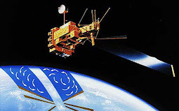
Heat and moisture from the ocean are constantly exchanged with Earth's atmosphere in a process that drives our weather and climate. Scientists at NASA and elsewhere use a variety of direct and satellite-based measurements to study the interactions between the ocean and atmosphere.

"These interactions result in large-scale global climate effects, the largest of which is the El Niño-Southern Oscillation," explained Josh Willis, a JPL oceanographer and climate scientist. This climate pattern appears in the tropical Pacific Ocean roughly every four to 12 years and has a powerful impact on the ocean and the atmosphere. It can disrupt global weather and influence hurricanes, droughts and floods. It can also raise or lower global temperatures by up to 0.2 degrees Celsius (0.4 degrees Fahrenheit).

The oscillation pattern is made up of linked atmospheric and oceanic components. The atmospheric component is called the Southern Oscillation, a pattern of reversing surface air pressure that see-saws between the eastern and western tropical Pacific. The ocean's response to this atmospheric shift is known as either "El Niño" or "La Niña" (Spanish for "the little boy" and "the little girl," respectively).

Where the wind blows

During El Niño, the normally strong easterly trade winds in the tropical eastern Pacific weaken, allowing warm water to shift toward the Americas and occupy the entire tropical Pacific. Heavy rains tied to this warm water move into the central and eastern Pacific. El Niño can cause drought in Indonesia and Australia and disrupt the path of the atmospheric jet streams over North and South America, changing winter climate.

Large El Niños, such as the most powerful El Niño of the past century in 1997 to 1998, tend to force Earth's average temperatures temporarily higher for up to a year or more. Large areas of the Pacific can be one to two degrees Celsius (around two to four degrees Fahrenheit) above normal, and the average temperature of the ocean surface tends to increase. The current El Niño began last October and is expected to continue into mid-2010. Scientists at NASA's Goddard Institute of Space Studies in New York estimate that if this pattern persists, 2010 may well go down as the warmest year on record.

El Niño's cold counterpart is La Niña. During La Niña, trade winds are stronger than normal, and cold water that usually sits along the coast of South America gets pushed to the mid-equatorial region of the Pacific. La Niñas are typically associated with less moisture in the air and less rain along the coasts of the Americas, and they tend to cause average global surface temperatures to drop. The last La Niña from 2007 to 2009 helped make 2008 the coolest year of the last decade. The end of that La Niña last year and subsequent transition into an El Niño helped contribute to last year's return to near-record global temperatures.

All the ocean's a stage

Both El Niño and La Niña play out on a larger stage that operates on decade-long timescales. The Pacific Decadal Oscillation, or PDO for short, describes a long-term pattern of change in the Pacific Ocean that alternates between cool and warm periods about every five to 20 years. The PDO can intensify the impacts of La Niña or diminish the impacts of El Niño. In its "cool, negative phase," warm water, which causes higher-than-normal sea-surface heights (because warmer water expands and takes up more space), forms a horseshoe pattern that connects the north, west and south Pacific with cool water in the middle. In its "warm, positive phase," these warm and cool regions are reversed, and warm water forms in the middle of the horseshoe.

Such phase shifts of the PDO result in widespread changes in Pacific Ocean temperatures and have significant global climate implications. During the 1950s and 1960s, the PDO was strongly negative, or cool, and global temperatures seemed to level off. During most of the 1980s, 1990s and 2000s, the Pacific was locked in a strong positive, or warm, PDO phase and there were many El Niños. We are currently in the early stages of a cool PDO phase that began around 2006. Cool, negative phases tend to dampen the effects of El Niños.

Willis said the PDO, El Niño and La Niña can strongly affect global warming due to increased greenhouse gases. "These natural climate phenomena can sometimes hide global warming caused by human activities, or they can have the opposite effect of accentuating it," he explained.

Wild ride

"These natural signals -- El Niños, La Niñas and PDOs -- can modulate the global record for a decade or two, giving us a wild ride with major climate and societal impacts," said Patzert. "They can have a powerful short-term influence on global temperatures in any particular year or decade. This can make it appear as if global warming has leveled off or become global cooling. But when you look at the long-term trend over the past 130 years, our world is definitely getting warmer. And that's the human-produced greenhouse gas signal."

Patzert said the recent climate record is like making a drive from the coast to the mountains. "As you rise slowly to higher and higher elevations, occasionally you hit a major speed bump, such as the 1997 to 1998 El Niño, and temperatures spike; or you hit potholes, such as cooler phases of the PDO, and temperatures dip," he said. "In the end, though, we still tend toward the top of the mountain, and the trend upwards is clear. We are driving ourselves into a warmer world."

Posted by CuttsMatt | at 10:05 PM | 0 comments

NASA Launches "A Warming World"


Will 2010 be the warmest year on record? How do the recent U.S. "Snowmageddon" winter storms and proof low temperatures in Europe fit into the bigger picture of long-term global warming? NASA has launched a fresh Web page to help people better understand the causes and effects of Earth's changing climate.

The new "A Warming World" page hosts a succession of new articles, videos, data visualizations, space-based descriptions and interactive visuals that offer unique NASA perspectives on this topic of global importance.

The page includes characteristic articles that explore the recent Arctic winter weather that has gripped the United States, Europe and Asia, and how El Nino and other longer-term ocean-atmosphere phenomena can affect global temperatures this year and in the future. A new video, "Piecing Together the Temperature Puzzle," illustrates how NASA satellites monitor climate change and help scientists better understand how our complex planet works.

The new Web page is available on NASA's Global Climate Change Web site at: http://climate.nasa.gov/warmingworld .

Posted by CuttsMatt | at 9:56 PM | 0 comments

Cassini Detects Plethora of Plumes, Hotspots at Enceladus


Newly released images from last November's swoop over Saturn's icy moon Enceladus by NASA's Cassini spacecraft reveal a forest of new jets spraying from prominent fractures crossing the south polar region and yield the most detailed temperature map to date of one fracture.

The new images from the imaging science subsystem and the composite infrared spectrometer teams also include the best 3-D image ever obtained of a "tiger stripe," a fissure that sprays icy particles, water vapor and organic compounds. There are also views of regions not well-mapped previously on Enceladus, including a southern area with crudely circular tectonic patterns.

The images and additional information are online at http://www.nasa.gov/cassini and http://saturn.jpl.nasa.gov.

"Enceladus continues to astound," said Bob Pappalardo, Cassini project scientist at NASA's Jet Propulsion Laboratory in Pasadena, Calif. "With each Cassini flyby, we learn more about its extreme activity and what makes this strange moon tick."

For Cassini's visible-light cameras, the Nov. 21, 2009 flyby provided the last look at Enceladus' south polar surface before that region of the moon goes into 15 years of darkness, and includes the most detailed look yet at the jets.

Scientists planned to use this flyby to look for new or smaller jets not visible in previous images. In one mosaic, scientists count more than 30 individual geysers, including more than 20 that had not been seen before. At least one jet spouting prominently in previous images now appears less powerful.

"This last flyby confirms what we suspected," said Carolyn Porco, imaging team lead based at the Space Science Institute in Boulder, Colo. "The vigor of individual jets can vary with time, and many jets, large and small, erupt all along the tiger stripes."

A new map that combines heat data with visible-light images shows a 40-kilometer (25-mile) segment of the longest tiger stripe, known as Baghdad Sulcus. The map illustrates the correlation, at the highest resolution yet seen, between the geologically youthful surface fractures and the anomalously warm temperatures that have been recorded in the south polar region. The broad swaths of heat previously detected by the infrared spectrometer appear to be confined to a narrow, intense region no more than a kilometer (half a mile) wide along the fracture.

In these measurements, peak temperatures along Baghdad Sulcus exceed 180 Kelvin (minus 135 degrees Fahrenheit), and may be higher than 200 Kelvin (minus 100 degrees Fahrenheit). These warm temperatures probably result from heating of the fracture flanks by the warm, upwelling water vapor that propels the ice-particle jets seen by Cassini's cameras. Cassini scientists will be testing this idea by investigating how well the hot spots correspond with the jet sources.

"The fractures are chilly by Earth standards, but they're a cozy oasis compared to the numbing 50 Kelvin (-370 Fahrenheit) of their surroundings," said John Spencer, a composite infrared spectrometer team member based at Southwest Research Institute in Boulder, Colo. "The huge amount of heat pouring out of the tiger stripe fractures may be enough to melt the ice underground. Results like this make Enceladus one of the most exciting places we've found in the solar system."

Some of Cassini's scientists infer that the warmer the temperatures are at the surface, the greater the likelihood that jets erupt from liquid. "And if true, this makes Enceladus' organic-rich, liquid sub-surface environment the most accessible extraterrestrial watery zone known in the solar system," Porco said.

The Nov. 21 flyby was the eighth targeted encounter with Enceladus. It took the spacecraft to within about 1,600 kilometers (1,000 miles) of the moon's surface, at around 82 degrees south latitude.

The Cassini-Huygens mission is a cooperative project of NASA, the European Space Agency and the Italian Space Agency. JPL, a division of the California Institute of Technology in Pasadena, manages the mission for NASA's Science Mission Directorate, Washington, D.C. The Cassini orbiter and its two onboard cameras were designed, developed and assembled at JPL. The imaging operations center is based at the Space Science Institute in Boulder, Colo. The composite infrared spectrometer team is based at NASA's Goddard Space Flight Center, Greenbelt, Md., where the instrument was built.

Posted by CuttsMatt | at 9:40 PM | 0 comments

Endeavour Safely Lands in Florida


Shuttle Launch Integration Manager Mike Moses said that space shuttle Endeavour's hall capped off a flawless mission. "The crew did an exceptional job," Moses said, referring to the complex task of installing Tranquility and its seven-windowed cupola to the International Space Station. "The landing today went as smooth as you can hope for -- by the numbers."

Moses wrapped up his remarks about the STS-130 mission by saying, "It was an exceptional mission -- I can't be happier with the success we had and look forward to repeating that on our next mission."

Shuttle Launch Director Mike Leinbach was extremely pleased with Endeavour's condition."One of the most magical things we get to do here at Kennedy Space Center is walk approximately the orbiter after a mission from space. She looks really, really good," Leinbach said.

Leinbach also congratulated Norm Knight and his team in the Mission Control Center at NASA's Johnson Space Center in Houston for a job well done.

Posted by CuttsMatt | at 11:26 PM | 0 comments

Behold the Aggressive History of Saturn's White Whale Moon


Like the battered white whale Moby Dick pointed Captain Ahab, Saturn's moon Prometheus surges toward the viewer in a 3-D image from NASA's Cassini spacecraft.

The picture exposes the irregular shape and circular surface scars on Prometheus, pointing to a violent history. These craters are almost certainly the remnants from impacts long ago.

Prometheus is one of Saturn's inmost moons. It orbits the gas-giant at a distance of about 140,000 kilometers (86,000 miles) and is 86 kilometers (53 miles) across at its widest point. The porous, icy world was originally discovered in images taken by NASA's Voyager 1 spacecraft back in 1980.

Cassini's narrow-angle camera captured two black-and-white images of the moon on Dec. 26, 2009, and the imaging team combined the images to make this new stereo view. It looks dissimilar from the "egg-cellent" raw image of Prometheus obtained on Jan. 27 because that view shows one of the short ends of the strangely shaped moon. In this 3-D image, the sun illuminate Prometheus at a different angle, making the moon's elongated body visible.

The Cassini Equinox Mission is a joint United States and European endeavor. The Jet Propulsion Laboratory, a division of the California Institute of Technology in Pasadena, manages the mission for NASA's Science Mission Directorate, Washington, D.C. The Cassini orbiter was intended, developed and assembled at JPL. For more information about the Cassini Equinox Mission visit: http://www.nasa.gov/cassini and http://saturn.jpl.nasa.gov.

Posted by CuttsMatt | at 11:22 PM | 0 comments

NASA's Stardust Burns for Comet, Less Than a Year Away


Just three days shy of one year before its planned flyby of comet Tempel 1, NASA's Stardust spacecraft has successfully performed a maneuver to adjust the time of its encounter by eight hours and 20 minutes. The delay maximizes the probability of the spacecraft capturing high-resolution images of the desired surface features of the 2.99-kilometer-wide (1.86 mile) potato-shaped mass of ice and dust.

With the spacecraft on the opposite side of the solar system and beyond the orbit of Mars, the trajectory correction maneuver began at 5:21 p.m. EST (2:21 p.m. PST) on Feb. 17. Stardust's rockets fired for 22 minutes and 53 seconds, changing the spacecraft's speed by 24 meters per second (54 miles per hour).

Stardust's maneuver placed the spacecraft on a course to fly by the comet just before 8:42 p.m. PST (11:42 p.m. EST) on Feb. 14, 2011 – Valentine's Day. Time of closest approach to Tempel 1 is important because the comet rotates, allowing different regions of the comet to be illuminated by the sun's rays at different times. Mission scientists want to maximize the probability that areas of interest previously imaged by NASA's Deep Impact mission in 2005 will also be bathed in the sun's rays and visible to Stardust's camera when it passes by.

"We could not have asked for a better result from a burn with even a brand-new spacecraft," said Tim Larson, project manager for the Stardust-NExT at NASA's Jet Propulsion Laboratory, Pasadena, Calif. "This bird has already logged one comet flyby, one Earth return of the first samples ever collected from deep space, over 4,000 days of flight and approximately 5.4 billion kilometers (3.4 billion miles) since launch."

Launched on Feb. 7, 1999, Stardust became the first spacecraft in history to collect samples from a comet and return them to Earth for study. While its sample return capsule parachuted to Earth in January 2006, mission controllers were placing the still viable spacecraft on a trajectory that would allow NASA the opportunity to re-use the already-proven flight system if a target of opportunity presented itself. In January 2007, NASA re-christened the mission "Stardust-NExT" (New Exploration of Tempel), and the Stardust team began a four-and-a-half year journey to comet Tempel 1. This will be humanity's second exploration of the comet – and the first time a comet has been "re-visited."

"Stardust-NExT will provide scientists the first opportunity to see the surface changes on a comet between successive visits into the inner solar system," said Joe Veverka, principal investigator of Stardust-NExT from Cornell University, Ithaca, N.Y. "We have theories galore on how each close pass to the sun causes changes to a comet. Stardust-NExT should give some teeth to some of these theories, and take a bite out of others."

Along with the high-resolution images of the comet's surface, Stardust-NExT will also measure the composition, size distribution, and flux of dust emitted into the coma, and provide important new information on how Jupiter family comets evolve and how they formed 4.6 billion years ago.

Stardust-NExT is a low-cost mission that will expand the investigation of comet Tempel 1 initiated by NASA's Deep Impact spacecraft. JPL, a division of the California Institute of Technology in Pasadena, manages Stardust-NExT for the NASA Science Mission Directorate, Washington, D.C. Joe Veverka of Cornell University is the mission's principal investigator. Lockheed Martin Space Systems, Denver Colo., built the spacecraft and manages day-to-day mission operations.

Posted by CuttsMatt | at 11:12 PM | 0 comments

Missing 'Ice Arches' Contributed to 2007 Arctic Ice Loss


In 2007, the Arctic lost an enormous amount of thick, multiyear sea ice, contributing to that year's record-low extent of Arctic sea ice. A new NASA-led study has create that the record loss that year was due in part to the absence of "ice arches," as expected-forming, curved ice structures that span the openings between two land points. These arches block sea ice from being pushed by winds or currents through narrow passages and out of the Arctic basin.

Beginning each fall, sea ice spreads across the surface of the Arctic Ocean until it becomes restricted by surrounding continents. Only a few passages -- including the Fram Strait and Nares Strait -- allow sea ice to escape.

"There are a couple of ways to lose Arctic ice: when it flows out and when it melts," said lead study investigator Ron Kwok of NASA's Jet Propulsion Laboratory in Pasadena, Calif. "We are trying to enumerate how much we're losing by outflow versus melt."

Kwok and colleagues found that ice arches were absent in 2007 from the Nares Strait, a relatively narrow 30- to 40-kilometer-wide (19- to 25-mile-wide) passage west of Greenland. Without the arches, ice exited freely from the Arctic. The Fram Strait, east of Greenland, is about 400 kilometers (249 miles) wide and is the channel through which most sea ice usually exits the Arctic.

Despite Nares' narrow width, the team reports that in 2007, ice loss through Nares equaled more than 10 percent of the quantity emptied on average each year through the wider Fram Strait.

"Until recently, we didn't think the small straits were important for ice loss," Kwok said. The findings were available this month in Geophysical Research Letters.

"One of our most significant goals is developing predictive models of Arctic sea ice cover," said Tom Wagner, cryosphere program manager at NASA Headquarters in Washington. "Such models are significant not only to understanding changes in the Arctic, but also changes in global and North American climate. Figuring out how ice is lost through the Fram and Nares straits is critical to increasing those models."

To find out more about the ice motion in Nares Strait, the scientists examined a 13-year record of high-resolution radar descriptions from the Canadian RADARSAT and European Envisat satellites. They found that 2007 was a unique year – the only one on record when arches failed to form, allowing ice to flow unobstructed through winter and spring.

The arches usually form at southern and northern points within Nares Strait when big blocks of sea ice try to flow during the strait's restricted confines, become stuck and are compressed by other ice. This grinds the flow of sea ice to a halt.

"We don't completely understand the circumstances conducive to the formation of these arches," Kwok said. "We do know that they are temperature-dependent because they only form in winter. So there's anxiety that if climate warms, the arches could stop forming."

To quantify the impact of ice arches on Arctic Ocean ice cover, the team tracked ice motion evident in the 13-year span of satellite radar images. They calculated the area of ice passing during an imaginary line, or "gate," at the entrance to Nares Strait. Then they incorporated ice thickness data from NASA's ICESat to estimate the volume lost through Nares.

They found that in 2007, Nares Strait drained the Arctic Ocean of 88,060 square kilometers (34,000 square miles) of sea ice, or a volume of 60 cubic miles. The quantity was more than twice the average amount lost through Nares each year between 1997 and 2009.

The ice lost through Nares Strait was some of the thickest and oldest in the Arctic Ocean.

"If indeed these arches are less likely to form in the future, we have to explanation for the annual ice loss through this narrow passage. Potentially, this could lead to an even more rapid decline in the summer ice extent of the Arctic Ocean," Kwok said.

Posted by CuttsMatt | at 11:05 PM | 0 comments

Jurassic Space: Telescopes Probe Ancient Galaxies Close To Us


Imagine discovering a living dinosaur in your backyard. Astronomers have found the astronomical corresponding of prehistoric life in our intergalactic backyard: a group of small, early galaxies that has waited 10 billion years to come together. These "late bloomers" are on their way to building a large elliptical galaxy.

Such encounters between dwarf galaxies are usually seen billions of light-years away and therefore occurred billions of years ago. But these galaxies, members of Hickson Compact Group 31, are comparatively nearby, only 166 million light-years away.

New images of this foursome by NASA's Hubble Space Telescope offer a window into the determining years of the universe, when the buildup of large galaxies from smaller construction blocks was common. The analysis was bolstered by infrared data from NASA's Spitzer Space Telescope and ultraviolet observations from NASA's Galaxy Evolution Explorer and Swift satellite. Those data helped the astronomers measure the total amount of star formation in the system.

Posted by CuttsMatt | at 9:09 PM | 0 comments

Enhanced 3D Model of Mars Crater Edge Display’s Ups and Downs


A dramatic 3D Mars view based on land modeling from NASA's Mars Reconnaissance Orbiter data shows "highs and lows" of Mojave Crater.

The vertical dimension is overstated three-fold compared with horizontal dimensions in the synthesized imagery of a portion of the crater's wall. The resulting images look like the view from a low-altitude aircraft. They reflect one use of digital modeling resulting from two observations by the orbiter's High Resolution Imaging Science Experiment camera.

This enhanced view shows material that has ponded and is backed up behind enormous blocks of bedrock in the crater's terrace walls. Hundreds of Martian collision craters have similar ponding with pitted surfaces. Scientists believe these "pitted ponds" are formed when material melted by the crater-causing impacts is captured behind the wall terraces.

Mojave Crater, one of the freshest large craters on Mars, is about 60 kilometers (37 miles) in diameter. In a sense, it is like the Rosetta Stone of Martian craters, because it is so fresh. Other craters of this size usually have already been affected by erosion, sediment and other geologic process. Fresh craters like Mohave reveal information about the collision process, including ejecta, melting and deposits.

Posted by CuttsMatt | at 9:00 PM | 0 comments